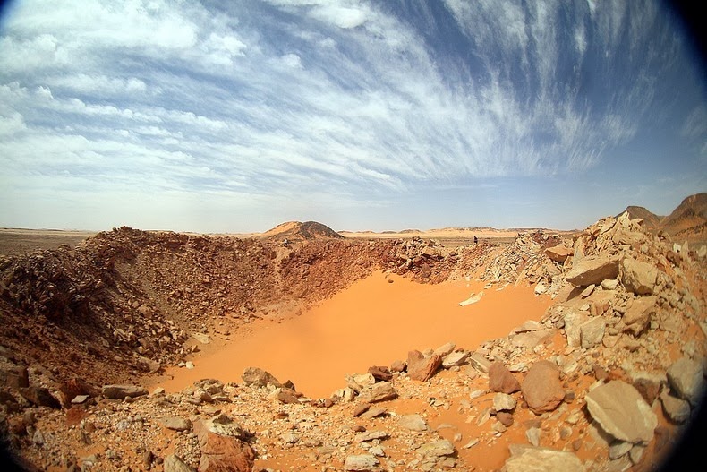
The Kamil crater is about 147 feet wide and 52 feet deep, and based on thousands of pieces of space rock that were collected from the surrounding desert, it’s estimated that the crater was created by a solid iron meteor about 4 feet wide and weighting between 5,000 to 10,000 kilograms. It slammed into the desert at speeds exceeding 3.5 kilometers a second, some 5,000 years ago.

One feature that makes this crater unique is the rayed structure that is visible around the crater. These are ejecta rays formed when the meteorite exploded leaving prominent splatter pattern around the blast site. While such ejecta rays are common on Moon or planets with a thin atmosphere, hey are exceedingly rare on Earth because erosion and other geological processes quickly erase such evidence.
It is possible Kamil Crater is the only impact crater on earth to have ejecta rays.


Source
