Monastery in Wadi Qelt

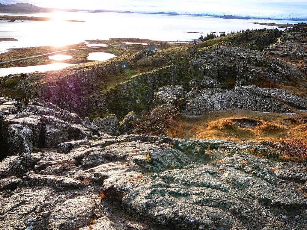
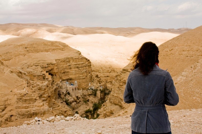
Wadi Qelt is a rocky canyon located in the Judaean Desert in the West Bank, originating near Jerusalem and terminating near Jericho, near the Dead Sea. In this isolated and barren valley a 4th-century monastery clings precariously to the rock walls. Originally built around a cave, the monastery grew in the 5th century under Greek Orthodox when its most famous monk and namesake Gorgias of Koziba inhabited the place.

St. George's Monastery began in the 4th century when a few monks seeking the desert experiences of the prophets settled around a cave where they believed Elijah was fed by ravens. The Greek Orthodox monastery was built in the late 5th century A.D. by John of Thebes, who became a hermit and moved from Egypt to Syria Palaestina in 480 A.D. The monastery was named St. George after the most famous monk who lived at the site – Gorgias of Koziba.


The monastery was destroyed in the year 614 by the Persians who swept through the valley and massacred the fourteen monks who dwelt there. The bones and skulls of the martyred monks can still be seen today in the monastery chapel. After the Persian invasion, the monastery lay abandoned for nearly 500 years until restoration attempts were made by bands of Crusaders in the 12th century. But after they were expelled, the monastery fell back into disuse. In 1878, a Greek monk, Kalinikos, settled here and restored the monastery, finishing it in 1901.

Today, the monastery is unique in its acceptance of female pilgrims and visitors, a precedent set through the tradition of a Byzantine noblewoman on a monastic tour who claimed that the mother of God had directed her there for healing from her incurable illness.

The monastery is located 20 km from Jerusalem along the historic road from Jericho to Jerusalem, which runs parallel to the valley. A pedestrian bridge across the Wadi Qelt connects the monastery to the road.


Source
READ MORE»

Cono de Arita, Argentina

Near the south border of Salar de Arizaro, the sixth largest salt flat on earth and the second largest in Argentina, 70 km from the village of Tolar Grande, lies a strange volcanic pyramid. An almost perfect cone, it rises unexpectedly in the middle of the salt pan. This is Cono de Arita and it looms majestically 122 meters above the Salar. Its name comes from the Aymara language where Arita means “sharp”.

In the early twentieth century it was believed that such a perfect cone could only have been built by man. But Cono de Arita is natural and believed to be a small volcano which lacked strength to burst through the curst and so never threw lava or developed a crater. Everything around the cone is black salt brought to the surface by ancient magma flows underground. According to the archaeological remains found in the cone, the place was a ceremonial center prior to the arrival of the Incas.


Source
READ MORE»

Cleft Island

Are you a super villain looking for a new lair? Then look no further. Take a look at Skull Rock, also known as Cleft Island. Situated off the coast of Wilsons Promontory in the state of Victoria it is at the southernmost point of the Australian mainland. It is beautiful, unspoiled and above all, peaceful. From a distance you may not think it is anything to write home about – and that’s the beauty of it. Your new hi-tech facility, where you can evolve your next fiendish plan without interruption, is hidden in plain sight. Plus it’s handy for the shops.


Agents of the various enemy states against which you plot may search for you but it will be in vain. The last place they will think of looking is this unremarkable and bare piece of rock protruding from the sea. Yet if we examine the island a little closer, you will soon see that the place is quite possibly perfect for an irredeemable scoundrel such as yourself.


As intrepid but foolhardy tourists have discovered, if you boat out to the island and begin to circumnavigate it, then the its secret is revealed. Yet the handful who make it round the corner have never lived to tell the tale thanks to the piranhabots we have recently had installed.


As you can see the island is, in fact, hollow and this affords the perfect bolt hole for any beleaguered anti-hero or stressed out super villain. Inside there is plenty of space both for your new domicile (shark pool or alligator pit come as extra) plus, with a little work, your precious cache of RT-2UTTKh Topol-M intercontinental ballistic missiles you stole from those idiot Russians last year.


For adversaries who dare approach the island itself there is also room for an ultra-modern short and medium range defense system (perhaps based on the Israeli Iron Dome model because let’s face it, shoulder-firing missiles are so last year). Not only that, Skull Island will easily accommodate your private army of assassins and mercenaries while they rest up between jobs.


Interest is extremely high and we have already had exciting offers from Auric Goldfinger Junior and the estate of the late and much missed Ernst Stavro Blofeld. If you are wondering about the price then it is probably not for you, but let us assure you of one thing. It’s a steal. So, what are you waiting for?


Source
READ MORE»

Iceland’s Divergence of the Plates

Thingvellir, Iceland: the landscape is wild and desolate but hauntingly beautiful. Yet the serene magnificence of the surroundings belies an astonishing fact. It is here as a result of massive, geological trauma.


This is one of the few places above sea level where you can see with your own eyes what happens when two major tectonic plates drift away from each other. In fact, Iceland owes its very existence to the tectonic processes which have played out along the Mid-Atlantic Ridge for millions of years. It was born of the ridge, which runs right through it.


Iceland rose above the waves as a direct result of the divergent and increasing boundary between the Eurasian and North American tectonic plates aided by the activity of the island’s own hotspot. The inexorable movement of the plates away from each other caused colossal eruptions and the resulting lava created rift valleys.


The lava would cool and then, little by little the movement of the plates would rift the lava fields apart directly above the tectonic plates. What you can see in Iceland today is the result – lengthy valleys of sheer rock, constrained by the parallel faults.


You have to go a long way back to discover the point at which all this activity started. The northern part of the ridge began to diverge around 150 million years ago. The southern part followed suit sixty million years later. Centimeter by centimeter this deviation continues to this day and tectonic activity inevitably goes hand in hand with earthquakes not to mention the eruption of volcanoes both old and new. Icelanders expect an eruption at least once a decade.


At Thingvellir (written Þingvellir in Icelandic), which was also the site of the world’s first parliament, you can see part of this vast rift system. Indeed, fissures form the eastern and western boundaries of the parliament lands. Although to our eyes they do not move, the distance between both sides of the plate boundaries increases by a few millimeters each year. When an earthquake strikes they have been known to shift by considerably more. Some have become lakes and waterfalls abound.


Many of the most momentous events in the human history of Iceland have taken place here, which is appropriate. Without the divergence of the Eurasian and North American tectonic plates which created this foreboding landscape there would not even be an Iceland.


The site’s geological exclusivity lies primarily in the fact that it is one of the only places on Earth where the properties of diverging tectonic plates are visibly present on dry land. Thingvellir became a National Park in 1928 and is now a designated UNESCO World Heritage Site.


Almannagjá is the largest example of where the continental drift between the two plates can be seen – it is the size of a small canyon. It is also one of the newest rifts and was formed about nine thousand years ago. Lava flowed down the plateau and over time shifts in the earth’s crust tended downward which created the rift. In places the walls of Almannagjá are over thirty meters high.


There is a legend in Iceland that Thingvellir is the final resting place of the Holy Grail, brought there by the poet and politician Snorri Sturluson in 1217 (accompanied by “eighty men from the east”). Yet despite this and other myths and legends that surround the place, inculcated no doubt by the sheer spectacle of the countryside, it is the geology which is truly astonishing and, at least in human terms, everlasting.


Source
READ MORE»

The Deepest Cave in the World

Krubera Cave, also known as Voronya Cave (Russian for “Crow’s Cave”) is the deepest known cave on Earth. It is located in the Arabika Massif, one of the largest high-mountain limestone karst massifs in the Western Caucasus region of Georgia. This mountain block contains several hundred caves that started to develop when the mountains started to rise more than 5 million years ago. Five of these caves are deeper than 1,000 meters; Krubera is 2197 meters deep and is the only known cave on Earth deeper than 2,000 meters.

Krubera Cave is a 16,058 meters long cave system which for most part consists of deep, vertical wells which are interconnected with passages. The cave starts high in the mountains, at an altitude of 2,256 meters, with a narrow entrance. Krubera Cave often is very narrow and had to be carved at many places to allow safe passage. At other places, the passageway is as large as subway tunnel.


At the depth of 200 meters, the cave divides into two main branches: Non-Kuybyshevskaya (explored to the depth of 1,293 m in 2008) and Main (2,197 m deep). At the depth of 1,300 meters the cave further divides into numerous branches.

When speleologists started exploring the cave, one of the hardships they faced were flooded tunnels called "sumps." When they encounter a sump, cavers have to put on scuba gear and charge ahead. One of the sumps – the deepest one - has been dived up to 52 m depth.

The cave now is very popular destination for the expeditions coming from many countries.


Source
READ MORE»