The Crimean Peninsula lies between the Black Sea and the Sea of Azov, just south of the Ukrainian mainland, and is almost completely surrounded by water. It is connected with the Ukrainian mainland by the Isthmus of Perekop - a strip of land about 5 to 7 kilometers wide, and is separated from the Russian region of Kuban on the east by the Strait of Kerch. To the northeast is located the Arabat Spit, a narrow strip of land that separates a system of shallow salt-water lagoons named Sivash, from the Sea of Azov.
These lagoons nearly cuts the Crimean Peninsula off from the mainland, and serves as a natural border between the Autonomous Republic of Crimea and the Kherson Oblast that passes through Sivash. To the north, the Isthmus of Perekop separates Sivash from the Black Sea and at the same time, connects the Crimean Peninsula to the mainland.

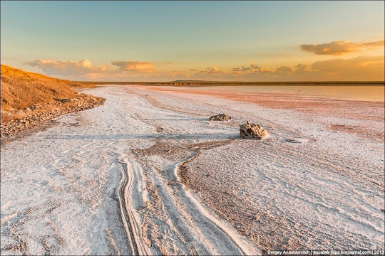
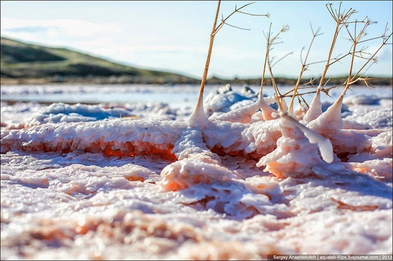
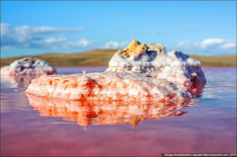
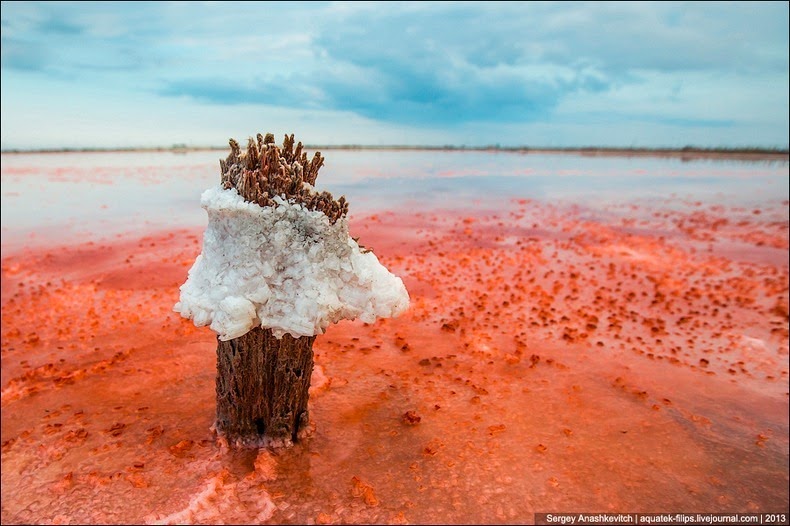
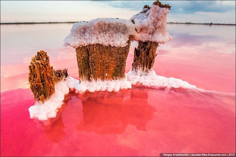
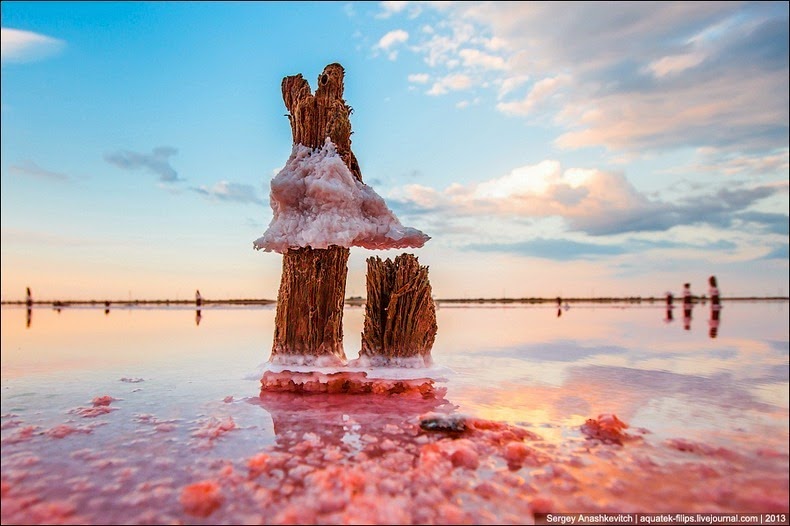
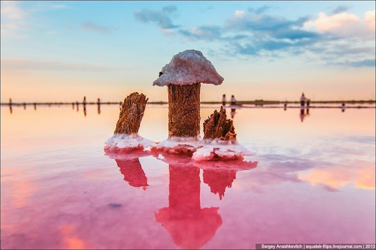
The Sivash lagoons are extremely shallow with a mean depth of just 50 cm to 1 meter. The deepest place is only about 3 meters. The bottom is covered with silt up to 5 meters thick. Because the lagoons are so shallow, water entering Sivash from the algae-ridden Sea of Azov evaporates quickly in summer, producing a horrible stench which has earned the lagoon the name of "Rotten Sea". Over 200 million tonnes of salt is estimated to exist in Sivash. Salt harvesting is hence, a big business in Crimea.
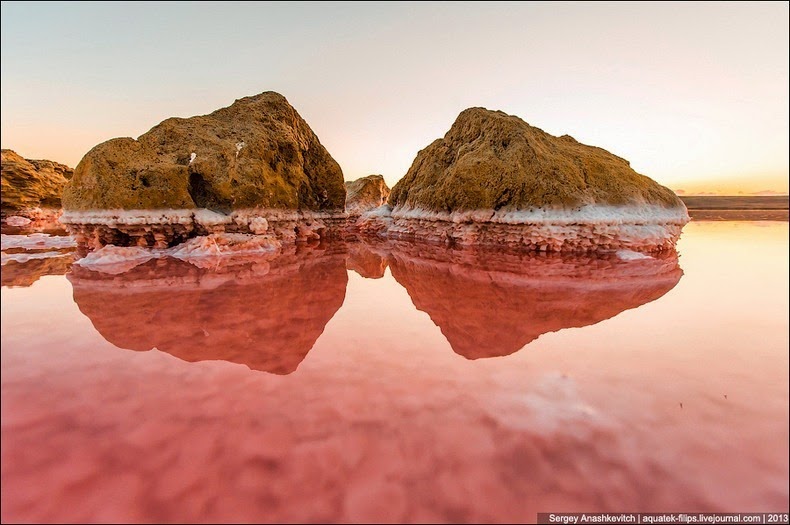
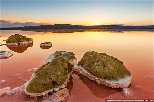
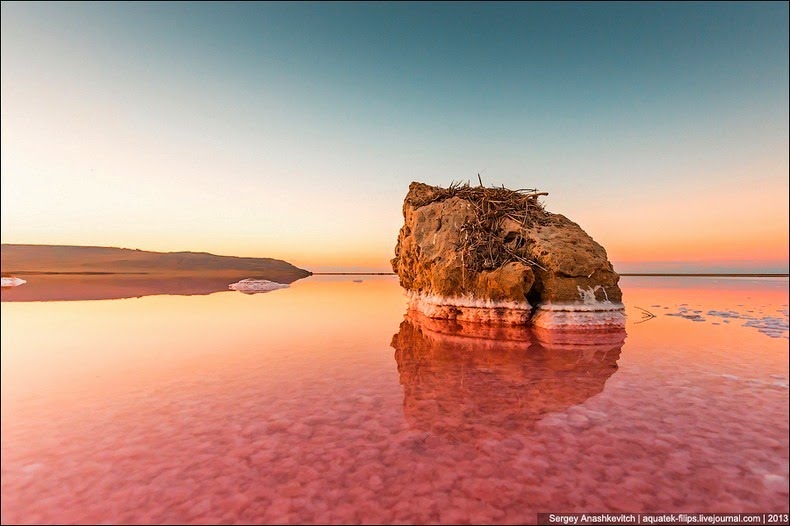
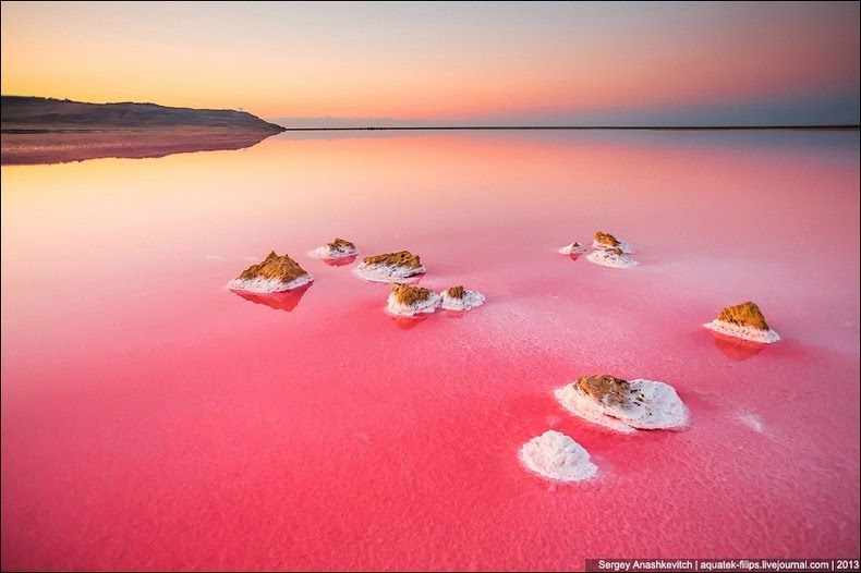
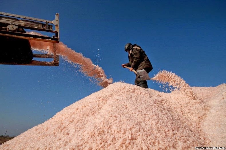
When water levels recede in summer, numerous pinkish-white salt pans are exposed, covering dozens of square km in the region. The pink color is the result of microalgae that thrive in salty conditions and produce high levels of beta-carotene, a reddish pigment that protects it from the region's intense sunlight. The salt is collected by traders and exported to Russia, the European Union, and to Japan, where it is prized for its purported value in fighting the effects of radiation.

This satellite picture shows the variety of colors the lagoons produce owing to its varied chemical composition. You can see colors of peach, mustard, lime green, blue, blue-green, beige, and brown. Thick layers of silt coat the bottoms of the shallow marshes, which are rich enough in mineral salts to supply a local chemical plant.


Source
READ MORE»
These lagoons nearly cuts the Crimean Peninsula off from the mainland, and serves as a natural border between the Autonomous Republic of Crimea and the Kherson Oblast that passes through Sivash. To the north, the Isthmus of Perekop separates Sivash from the Black Sea and at the same time, connects the Crimean Peninsula to the mainland.
The Sivash lagoons are extremely shallow with a mean depth of just 50 cm to 1 meter. The deepest place is only about 3 meters. The bottom is covered with silt up to 5 meters thick. Because the lagoons are so shallow, water entering Sivash from the algae-ridden Sea of Azov evaporates quickly in summer, producing a horrible stench which has earned the lagoon the name of "Rotten Sea". Over 200 million tonnes of salt is estimated to exist in Sivash. Salt harvesting is hence, a big business in Crimea.
When water levels recede in summer, numerous pinkish-white salt pans are exposed, covering dozens of square km in the region. The pink color is the result of microalgae that thrive in salty conditions and produce high levels of beta-carotene, a reddish pigment that protects it from the region's intense sunlight. The salt is collected by traders and exported to Russia, the European Union, and to Japan, where it is prized for its purported value in fighting the effects of radiation.
This satellite picture shows the variety of colors the lagoons produce owing to its varied chemical composition. You can see colors of peach, mustard, lime green, blue, blue-green, beige, and brown. Thick layers of silt coat the bottoms of the shallow marshes, which are rich enough in mineral salts to supply a local chemical plant.
Source