The Salton Sea is a shallow, saline lake located 226 feet below sea level, occupying the lowest elevations of the Salton Sink in the Colorado Desert of Imperial and Riverside counties in Southern California. With an average surface area of 1,360 square km, it is the largest lake in California. Yet, just a century ago, the lake didn’t even exist.
The Salton Sea was a vast geological depression, a dry bed, that was often referred to as the “Colorado Desert” throughout the Spanish period of California's history. A flood in 1905 poured the Colorado River into the sink, and by the time authorities managed to stop the flooding two years later, the largest lake in California had already formed.

In 1900, the California Development Company began construction of irrigation canals to divert water from the Colorado River into the Salton Sink, a dry lake bed. After construction of these irrigation canals, the Salton Sink became fertile for a time, allowing farmers to plant crops. In 1905, heavy rainfall and snowmelt caused the Colorado River to swell, pouring water down the canal and into the Salton Sink. The flood waters breached two dikes and formed two new rivers that quickly inundated the valley. Over a period of approximately two years these two newly created rivers - New River and the Alamo River - sporadically carried the entire volume of the Colorado River into the Salton Sink. As the basin filled, the town of Salton, a Southern Pacific Railroad siding, and Torres-Martinez Native American land were also submerged.
Intermittent flooding of the Imperial Valley by the Colorado river continued. Eventually it led to the construction of Hoover Dam in the 1930s and the flooding finally stopped. Salton Sea is now fed by the New, Whitewater, and Alamo rivers, as well as agricultural runoff, drainage systems, and creeks. The average annual inflow of 1.68 cubic km is enough to maintain a maximum depth of 52 feet and a total volume of about 9.3 cubic km.
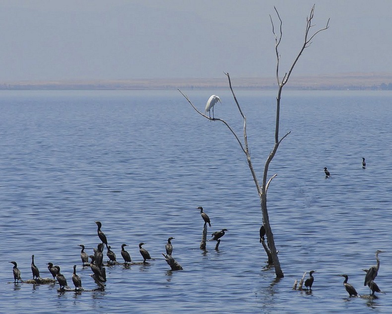
In 1950, the California Department of Fish and Game released thousands of fish into the Salton Sea. A few species survived and Salton Sea quickly became a fisherman’s paradise. With new fish to eat, the Sea also became a new stopover point for migratory birds. Over 400 species have been documented at the Salton Sea. Around 30% of the remaining population of the American white pelican lives in its shores, and the lake is also a major resting stop on the Pacific Flyway.

By 1960, Salton Sea had developed into a resort with Salton City, Salton Sea Beach, and Desert Shores on the western shore and Desert Beach, North Shore, and Bombay Beach built on the eastern shore. Several multi-million dollar marinas and yacht clubs sprung up around the shoreline. Golf courses began to appear everywhere. Thousands showed up to watch the Salton Sea 500, a 500 mile powerboat endurance race.
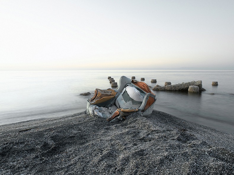
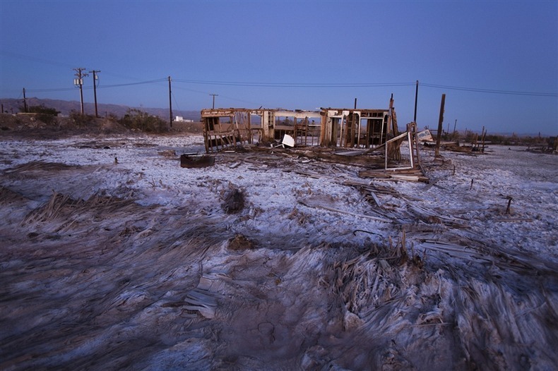
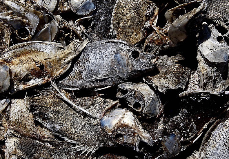
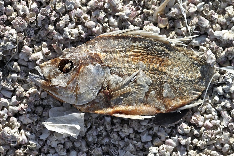
Salton Sea’s economic boom however didn’t last long. Since the Salton Sea has no outlet, the salt and chemicals dumped by agricultural runoffs and industries began to rise while the water level remained the same, resulting in increased concentration of toxic chemicals. Over the years, fish began to die in large masses - tens of thousands of dead fish and birds began regularly washing up on the shore of the Salton Sea. When in the summer of 1999, 7.6 million Tilapia died from oxygen starvation caused by the overabundant algae, the authorities knew the situation was grim. Their rotting carcasses rimmed parts of the Sea for over ten years. Combined with the decaying algae, the smell was overwhelming.
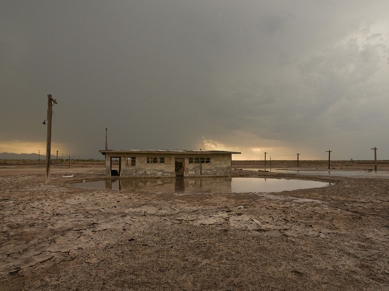
In the late 1990s, the Salton Sea Authority, a local joint powers agency, and the US Bureau of Reclamation began efforts to evaluate and develop an alternative to save the Salton Sea. Many concepts have been proposed. Some advocate piping water from the Sea to a wetland in Mexico to remove excess salt, others prefer bringing in more water from the Gulf of California to dilute the salt. Still others believe the only way to save the Sea is by cleaning it up and keeping it as a valued part of the Pacific Flyway, constructing evaporation ponds in its northern half as a way of desalinating the water.
Perhaps the Salton Sea is destined to dry up just like a giant puddle in the pavement does. Geologists have found evidences that prove that the Salton Sink was alternately a fresh water lake and a dry desert basin, in a cycle that repeated itself countless times over hundreds of thousands of years. The 1905 creation of the lake was just the latest natural cycle. However, this time humans intervened and the ecosystem changed, perhaps forever.
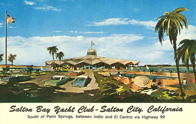
Postcards of Salton Sea resorts during its heydays.


Source
READ MORE»
The Salton Sea was a vast geological depression, a dry bed, that was often referred to as the “Colorado Desert” throughout the Spanish period of California's history. A flood in 1905 poured the Colorado River into the sink, and by the time authorities managed to stop the flooding two years later, the largest lake in California had already formed.
In 1900, the California Development Company began construction of irrigation canals to divert water from the Colorado River into the Salton Sink, a dry lake bed. After construction of these irrigation canals, the Salton Sink became fertile for a time, allowing farmers to plant crops. In 1905, heavy rainfall and snowmelt caused the Colorado River to swell, pouring water down the canal and into the Salton Sink. The flood waters breached two dikes and formed two new rivers that quickly inundated the valley. Over a period of approximately two years these two newly created rivers - New River and the Alamo River - sporadically carried the entire volume of the Colorado River into the Salton Sink. As the basin filled, the town of Salton, a Southern Pacific Railroad siding, and Torres-Martinez Native American land were also submerged.
Intermittent flooding of the Imperial Valley by the Colorado river continued. Eventually it led to the construction of Hoover Dam in the 1930s and the flooding finally stopped. Salton Sea is now fed by the New, Whitewater, and Alamo rivers, as well as agricultural runoff, drainage systems, and creeks. The average annual inflow of 1.68 cubic km is enough to maintain a maximum depth of 52 feet and a total volume of about 9.3 cubic km.
In 1950, the California Department of Fish and Game released thousands of fish into the Salton Sea. A few species survived and Salton Sea quickly became a fisherman’s paradise. With new fish to eat, the Sea also became a new stopover point for migratory birds. Over 400 species have been documented at the Salton Sea. Around 30% of the remaining population of the American white pelican lives in its shores, and the lake is also a major resting stop on the Pacific Flyway.
By 1960, Salton Sea had developed into a resort with Salton City, Salton Sea Beach, and Desert Shores on the western shore and Desert Beach, North Shore, and Bombay Beach built on the eastern shore. Several multi-million dollar marinas and yacht clubs sprung up around the shoreline. Golf courses began to appear everywhere. Thousands showed up to watch the Salton Sea 500, a 500 mile powerboat endurance race.
Salton Sea’s economic boom however didn’t last long. Since the Salton Sea has no outlet, the salt and chemicals dumped by agricultural runoffs and industries began to rise while the water level remained the same, resulting in increased concentration of toxic chemicals. Over the years, fish began to die in large masses - tens of thousands of dead fish and birds began regularly washing up on the shore of the Salton Sea. When in the summer of 1999, 7.6 million Tilapia died from oxygen starvation caused by the overabundant algae, the authorities knew the situation was grim. Their rotting carcasses rimmed parts of the Sea for over ten years. Combined with the decaying algae, the smell was overwhelming.
In the late 1990s, the Salton Sea Authority, a local joint powers agency, and the US Bureau of Reclamation began efforts to evaluate and develop an alternative to save the Salton Sea. Many concepts have been proposed. Some advocate piping water from the Sea to a wetland in Mexico to remove excess salt, others prefer bringing in more water from the Gulf of California to dilute the salt. Still others believe the only way to save the Sea is by cleaning it up and keeping it as a valued part of the Pacific Flyway, constructing evaporation ponds in its northern half as a way of desalinating the water.
Perhaps the Salton Sea is destined to dry up just like a giant puddle in the pavement does. Geologists have found evidences that prove that the Salton Sink was alternately a fresh water lake and a dry desert basin, in a cycle that repeated itself countless times over hundreds of thousands of years. The 1905 creation of the lake was just the latest natural cycle. However, this time humans intervened and the ecosystem changed, perhaps forever.
Postcards of Salton Sea resorts during its heydays.
Source