
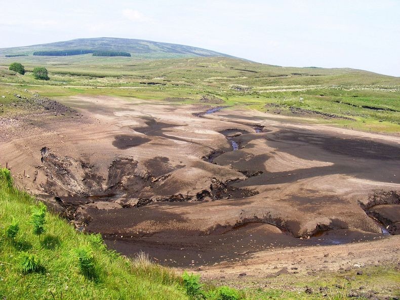
Loughareema, also known as the Vanishing Lake, is located on the coast road, just a few miles from the seaside town of Ballycastle in Ireland. The lake sits on a leaky chalk-bed with a “plug hole” that often becomes jammed with peat causing the Loughareema depression to fill, especially during heavy rain. When the plug clears, the lake drains rapidly underground. A passerby who is not aware of the lake and its disappearing act would never even know it existed in the first place.
Interestingly, the road to Ballycastle runs right through the lake, though the modern road sits high enough to avoid flooding, unlike the original. It is quite possible that even the road engineers who built road were fooled by the lake’s trickery. In former days the route was frequently under water, sometimes for weeks on end, making crossing treacherous.

It was during one particularly bad state of flooding in 1898, a certain Colonel John Magee McNeille, anxious to catch the 3 pm train from the town, persuaded his coachman to drive a covered wagon pulled by two horses through the lake. When they reached the middle of the lake, the cold water reached the bellies of the horse who became nervous. The coachman used the whip, the horse went rearing up on its back legs and turned to the side. The Colonel, his coachmen and the two horses soon succumbed to the treacherous, cold waters.
Since that fateful day many people have reported seeing a phantom carriage pulled by two horses and ridden by a military man on the lonely shores of Loughareema.
The road has been raised about the maximum flood level, and just in case, a stone wall has been erected on each side of the road as it approaches the Lough so that no-one can ever meet the same watery end as Colonel McNeille did on the afternoon of 30 September 1898.

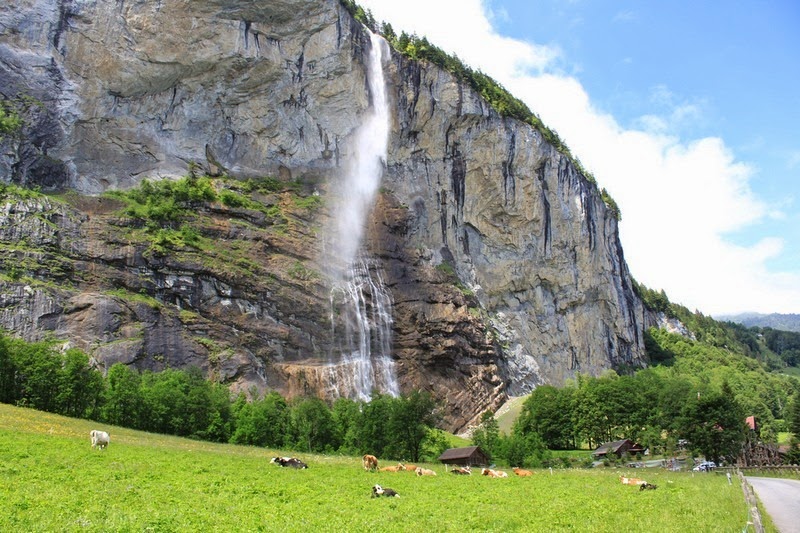
Loughareema, nearly full.

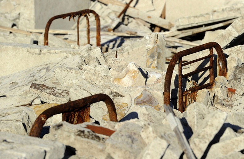
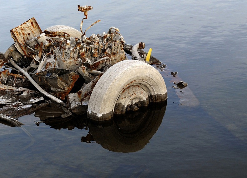
Loughareema, empty.
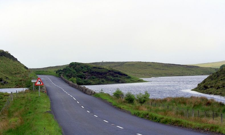
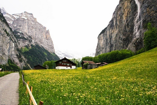
Loughareema and the new elevated road through it.


Source
READ MORE»
Interestingly, the road to Ballycastle runs right through the lake, though the modern road sits high enough to avoid flooding, unlike the original. It is quite possible that even the road engineers who built road were fooled by the lake’s trickery. In former days the route was frequently under water, sometimes for weeks on end, making crossing treacherous.
It was during one particularly bad state of flooding in 1898, a certain Colonel John Magee McNeille, anxious to catch the 3 pm train from the town, persuaded his coachman to drive a covered wagon pulled by two horses through the lake. When they reached the middle of the lake, the cold water reached the bellies of the horse who became nervous. The coachman used the whip, the horse went rearing up on its back legs and turned to the side. The Colonel, his coachmen and the two horses soon succumbed to the treacherous, cold waters.
Since that fateful day many people have reported seeing a phantom carriage pulled by two horses and ridden by a military man on the lonely shores of Loughareema.
The road has been raised about the maximum flood level, and just in case, a stone wall has been erected on each side of the road as it approaches the Lough so that no-one can ever meet the same watery end as Colonel McNeille did on the afternoon of 30 September 1898.
Loughareema, nearly full.
Loughareema, empty.
Loughareema and the new elevated road through it.
Source


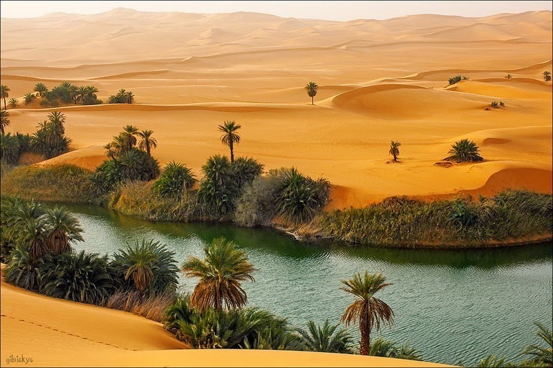


 Gaberoun Lake