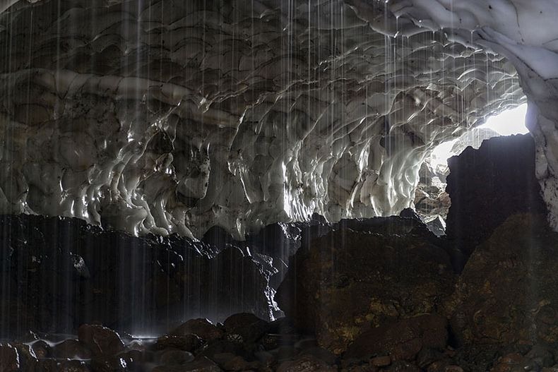
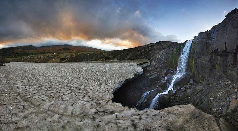
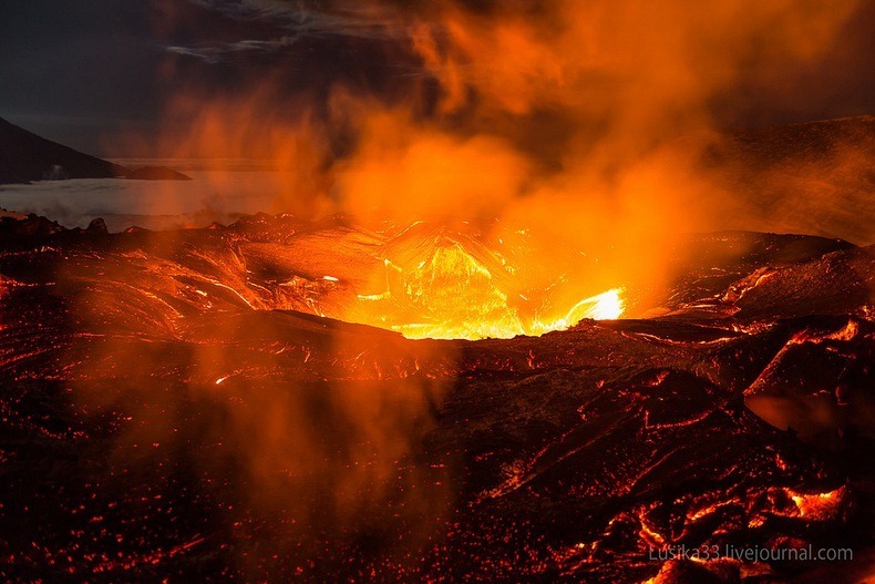
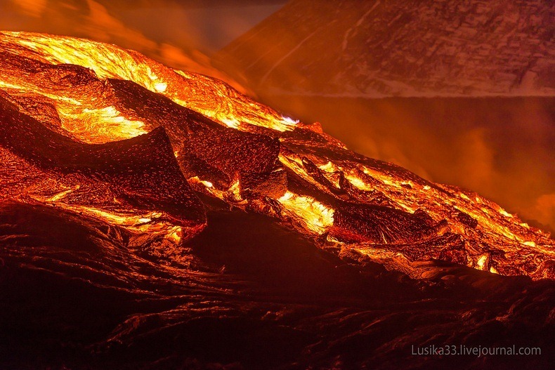
The Plosky Tolbachik volcano on the Kamchatka Peninsula, in the far east of Russia, has been erupting since November 27, last year, after remaining dormant for 36 years. The volcano has been spewing lava from two fissures, whose flow have destroyed several buildings including a station of the Institute of Volcanology and Seismology, the Leningradskaya research base and a base of the Volcanoes of Kamchatka natural park. The erupting volcano has become a sightseeing hotspot for crowds of thrill-seeking tourists eager to see flows of lava and clouds of ash.
Two Russian daredevil photographers Liudmila and Andrey captured these stunning images while visiting the volcano with a team of volcanologists.

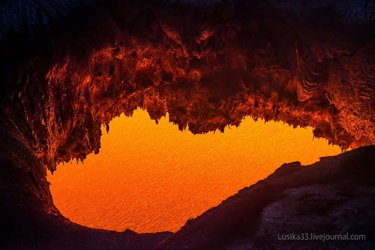
The duo told the Siberian Times in an interview: “For us who were at the volcano explosion site for the first time it was quite unnerving. We had been waiting for the dark to come at the site where a lava tube was coming out of the surface. It was a full moon and perhaps it does make a difference on how active the explosion was. Perhaps it was the same principle that works with the tide in the ocean.”
“We had been standing up quietly, sipping vodka. Lava was flowing past calmly. At some point I left to pick up my camera that was lying on the rock - to make sure no-one steps on it, and got to the edge of the lava crater. I was just on time to see that it is filling with lava, while the lava stream in the canyon has almost dried out.
“Andrey suggested to experienced volcanologists that they should know which way to run. The experts dismissed his concerns.”
“It calmed me down for a bit - until the ground under our feet started to crack”, Andrey recalls.
“The lava stream was only touching the surface close to the place where we stood. It kept moving above us, too, just under the crust. So at some point we realised that something was in the way of lava stream, and it was getting through every hole and crack it could find - or break through. It looks like that the crater, on the edge of which we were standing, actually saved our lives because at least lava started leaking inside it, instead of swelling up the slope. It was also lucky that the crater was big enough to let the stream go through it without obstacles. And we were extremely lucky that the canyon was not blocked completely, so that a part of the lava continued moving through.”
“Our experienced volcanologists were still laughing at how scared we were at this point - until a fountain of gas beamed out from the centre of it, which meant that lava could have started gushing out - and we would be right under the lava rain! This is when panic got to all of us. And the lava stream went down right on the people that stood down the canyon, taking pictures of it."
One of the volcanologists lost his backpack to the lava. The photographers escaped safely with their sensational pictures.


Source
READ MORE»
Two Russian daredevil photographers Liudmila and Andrey captured these stunning images while visiting the volcano with a team of volcanologists.
The duo told the Siberian Times in an interview: “For us who were at the volcano explosion site for the first time it was quite unnerving. We had been waiting for the dark to come at the site where a lava tube was coming out of the surface. It was a full moon and perhaps it does make a difference on how active the explosion was. Perhaps it was the same principle that works with the tide in the ocean.”
“We had been standing up quietly, sipping vodka. Lava was flowing past calmly. At some point I left to pick up my camera that was lying on the rock - to make sure no-one steps on it, and got to the edge of the lava crater. I was just on time to see that it is filling with lava, while the lava stream in the canyon has almost dried out.
“Andrey suggested to experienced volcanologists that they should know which way to run. The experts dismissed his concerns.”
“It calmed me down for a bit - until the ground under our feet started to crack”, Andrey recalls.
“The lava stream was only touching the surface close to the place where we stood. It kept moving above us, too, just under the crust. So at some point we realised that something was in the way of lava stream, and it was getting through every hole and crack it could find - or break through. It looks like that the crater, on the edge of which we were standing, actually saved our lives because at least lava started leaking inside it, instead of swelling up the slope. It was also lucky that the crater was big enough to let the stream go through it without obstacles. And we were extremely lucky that the canyon was not blocked completely, so that a part of the lava continued moving through.”
“Our experienced volcanologists were still laughing at how scared we were at this point - until a fountain of gas beamed out from the centre of it, which meant that lava could have started gushing out - and we would be right under the lava rain! This is when panic got to all of us. And the lava stream went down right on the people that stood down the canyon, taking pictures of it."
One of the volcanologists lost his backpack to the lava. The photographers escaped safely with their sensational pictures.
Source