

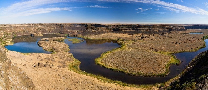
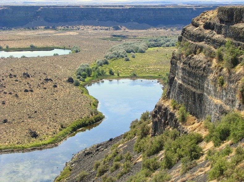
Nearly twenty thousand years ago, as glaciers moved south through North America, an ice sheet dammed the Clark Fork River near Sandpoint, Idaho. Consequently, a significant portion of western Montana flooded, forming the gigantic Lake Missoula. Water covering three thousand square miles of northwest Montana, about the volume of Lake Ontario, was locked behind this glacial dam. Eventually, rising water in lake Missoula broke through the ice dam creating a cataclysmic flood that spilled into Glacial Lake Columbia, and then down the Grand Coulee. The massive torrent (known as the Missoula Flood) ran wild through the Idaho panhandle, the Spokane River Valley, much of eastern Washington and into Oregon, flooding the area that is now the city of Portland under 400 feet of water. The tremendous force of the Dry falls eroded away so much earth and rock, that the precipice fell back by 15 miles to its present position.
Once the ice sheet that obstructed the Columbia melted, the river returned to its normal course, leaving the Grand Coulee and the falls dry. Today, this massive cliff can be viewed from the Dry Falls Interpretive Center, part of Sun Lakes State Park, and located on Route 17 near the town of Coulee City.
It is generally accepted that this process of ice-damming of the Clark Fork, refilling of Lake Missoula and subsequent cataclysmic flooding happened dozens of times over the years of the last Ice Age.


Source