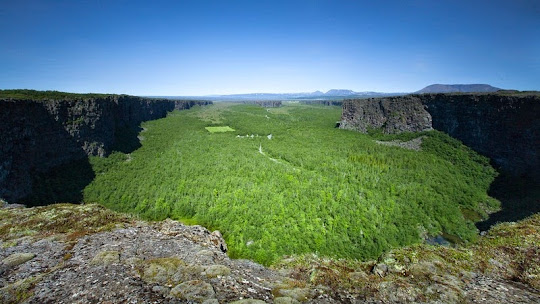
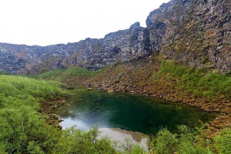
Located in the north of Iceland, at a distance of about 65 km from the harbor town of Husavik, within Vatnajökull National Park, lies an enormous horseshoe shaped depression called the Asbyrgi Canyon. The canyon is 3.5 km long and 1 km wide, and its steep sides are formed by cliffs up to 100 metres in height. The canyon floor is heavily forested with trees such as birch, willow, fir, larch, and pine, but during summer it’s possible to take the road that leads through the thick forest and all the way to the foot of the cliff where there is small lake called Botnstjorn, where you will find a variety of waterfowl species. The well vegetated area between the canyon walls is a very popular recreational area, especially among families, and local festivals are celebrated there. The canyon is divided in the middle by a 250 meters wide raised island called Eyjan, from which hikers can enjoy spectacular views across the land.

According to Norse mythology, Ásbyrgi was formed when Odin's eight-legged horse, Sleipnir, touched one of its feet to the ground here. Thus, the canyon is also known as ‘Sleipnir’s footprint’. However, geologist believe that Asbyrgi was most formed by two catastrophic glacial flooding of the river Jökulsá á Fjöllum after the last Ice Age. The first one occurred when the ice melted some 10,000 years ago, and then another occurred some 3,000 years ago when the Hekla volcano erupted underneath the Vatnajökull ice cap and melted the ice. The river has since changed its course and now runs about 2 km to the east.


Source
READ MORE»

According to Norse mythology, Ásbyrgi was formed when Odin's eight-legged horse, Sleipnir, touched one of its feet to the ground here. Thus, the canyon is also known as ‘Sleipnir’s footprint’. However, geologist believe that Asbyrgi was most formed by two catastrophic glacial flooding of the river Jökulsá á Fjöllum after the last Ice Age. The first one occurred when the ice melted some 10,000 years ago, and then another occurred some 3,000 years ago when the Hekla volcano erupted underneath the Vatnajökull ice cap and melted the ice. The river has since changed its course and now runs about 2 km to the east.


Source


