Bunda Cliffs, Australia

Located on the Great Australian Bight in Southern Australia, is the vast, featureless Nullarbor Plain - the world’s largest single piece of limestone, covering an area of 270,000 square km and extending some 1,000 km from the east to the west. The area is so flat that the Trans Australian Railway runs across its surface for about 483 kilometers in a completely straight line. On the surface of the plain there are areas of slight depressions where sparse rainfall has slowly dissolved away some of the limestone. There are also places where underground caves or sinkholes have collapsed to form dents in the surface. But mostly, the plain is horizontally flat and devoid of trees, as its Latin name suggests. The Nullarbor Plain ends abruptly at the spectacular Bunda Cliffs, comprising a 200-kilometer-long precipice curving around the Great Australian Bight.
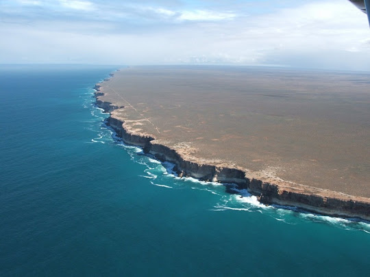


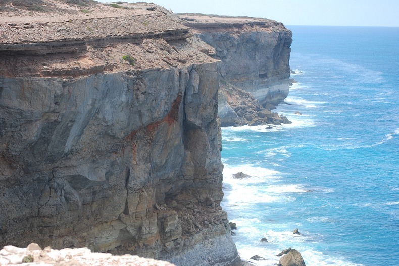
Bunda Cliffs form the southern edge of the Nullarbor Plain which extends far inland. The white coloured base you see near the bottom of the cliff face is Wilson Bluff Limestone. This chalky material formed as part of an ancient seabed when Australia began to separate from Antarctica 65 million years ago. This Wilson Limestone is up to 300 metres thick but only the upper portion is visible in Bunda Cliffs.

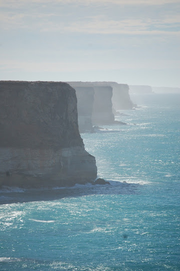
Above the white Wilson Limestone are whitish, grey or brown layers of limestone or crystalline rock. Some layers incorporate marine fossils including worms and molluscs indicating their marine origin. Other layers are made up entirely of marine sediment (foraminifera). The cliffs are capped by a hardened layer of windblown sand laid down between 1.6 million and 100,000 year ago.

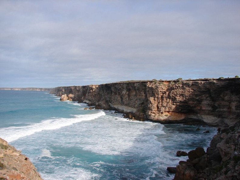
The cliffs are some 60 to 120 meters high and sheer, and can be viewed from several viewing points along the Eyre Highway east of Eucla and west of Nullarbor roadhouse. But they are better appreciated from the air. The Eyre Highway, Australia’s main east–west link, follows the line of this spectacular coast less than a kilometer inland. The highway was named after Edward John Eyre, who along with John Baxter and three aboriginals, set off from Fowlers Bay in February 1841 in an attempt to reach Albany in Western Australia across the Nullarbor Plain. Lack of water and extreme hardship gave rise to a mutiny and two of the aboriginal boys shot John Baxter and absconded. Eyre and the third Aborigine, Wylie, continued on their journey and completed the crossing in June 1841. The Eyre Highway was laid exactly a century later in 1941.

Over a distance of 85 kilometers along the highway, there are five main lookouts on the cliffs with signed, gravel access roads from the highway. The western lookout is the most popular because visitors can walk to piece of rock jutting out of the cliff that offers a vantage looking point.

At the eastern end of Bunda Cliffs there is a lookout at the Head of the Bight where visitors can stay for hours watching Southern Right Whales in the ocean below the cliffs. Southern Right Whales migrate from the sub-Antarctic in the autumn and give birth to calves in inshore water along the southern Australian coast, then remain in the vicinity for months while the calves put on weight. Head of the Bight is one of these calving/mating grounds.








Source
READ MORE»
Tufa Towers of Mono Lake, California

Mono Lake is a shallow salt water lake located in the high desert on the eastern slope of the Sierra Nevada Mountains, in California in the United States. The lake has no outlet to the ocean causing high levels of salts to accumulate in the waters. As a consequence of its high salinity, no fish live in Mono Lake, but there are plenty of brine shrimp that thrive in its waters. Over two million annual migratory birds use Mono Lake as a stop over and resting place as they fly to South America or the tropical oceans. They feed on the shrimps, lay eggs and hatch their young ones here.

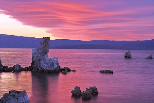
The most unusual feature of Mono Lake are its dramatic tufa towers emerging from the surface. These rock towers form when underwater springs rich in calcium mix with the waters of the lake, which are rich in carbonates. The resulting reaction forms limestone. Over time the buildup of limestone formed towers, and when the water level of the lake dropped the towers became exposed.


But the drop in surface level was not a natural phenomenon. It started in 1941 when the city of Los Angeles began diverting the streams that fed Mono Lake. So much water was drawn away from the lake that the surface level of Mono Lake fell by 45 feet. By 1982 the lake was reduced to 37,688 acres (15,252 ha) having lost 31 percent of its 1941 surface area. As a result, alkaline sands and the once submerged tufa towers became exposed and a land bridge between the shoreline and an island was formed. The island served as a major breeding area for migratory birds. Until now, the island was a safe haven protected by waters all around, but the newly formed land bridge invited predators such as coyotes to the island, who fed on eggs and chicks forcing the breeding colony of birds to abandon the site.

In addition to migratory birds, several other species spend months nesting at Mono Lake, among which are California gulls. After the land bridge to the Negit Island became exposed in the late 1970s, the California gulls have also moved to nearby islets and have established new, and less protected, nesting sites.

A study conducted in 1988 predicted that if the drying of Mono Lake was allowed to continue, by 1999 the salinity of the lake would increase to a level where the productivity of the brine shrimp would begin to decline. Finally by 2012, the existing lake ecosystem could cease to function because the lake salinities would reach such high levels that brine shrimp and brine flies could no longer survive, thus depriving 1.3 million birds of their food source at the lake.

Based on the report, in 1994, the California State Water Resources Control Board issued an order to protect Mono Lake. The goal is to return the lake to the level of 6,392 feet above sea level. As of July 2012, Mono Lake was at 6,383.3 feet above sea level but frequent droughts in the region have made achieving the goal more and more difficult.


NASA Landsat 7 image


Source
READ MORE»

Tarim Desert Highway in Taklamakan Desert, China

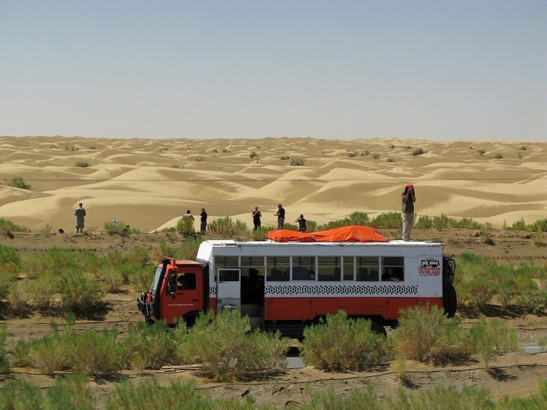
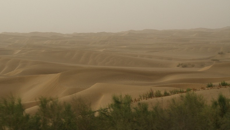
The Tarim Desert Highway across the Taklamakan desert, in China, links the cities of Luntai and Minfeng on the northern and southern edges of the Tarim basin. The total length of the highway is 552 km, of which approximately 446 km is built across uninhabited areas covered by shifting sand dunes, 20 metes tall, that frequently bury the highway.

To prevent the highway from getting buried by the encroaching sand dunes, rows of vegetation were planted on both sides of the road to anchor the sand with their roots. A massive irrigation system was constructed that pump water from underground reservoirs to sustain the artificial ecosystem. Hundreds of workers were employed, housed every four kilometers along the road who tend to the short, small-leaved rose willows, sacsaoul and buckthorn and make sure they do not die. The water comes from wells, bored 100 meters deep into an aquifer which sits under the desert, which in turn is fed by the rivers that flow down from the surrounding mountains. Despite the high saline content in the water, the green belt continues to thrive.


A lone pumping station by the side of the Tarim Desert Highway.

For five years the government experimented with various plants that could survive desert conditions. In 1999, a pilot project of sand protection afforestation belt along a 6.3-kilometer section of the highway was completed. In 2001, the project was expanded until a 30.8-km stretch along the highway was afforested. The project was finally approved by the state in 2003. Today, nearly four-fifth of the highway is flanked by 72 to 78 meter-wide tree belt, covering a total area of more than 3,000 hectares.

The Tarim Desert Highway has great economic significance, which is why such expensive and elaborate measures had to be adopted just to keep the highway usable. The highway was built in 1995 to service an essential north-south oil pipeline, that lies underneath the Taklamakan desert. Beneath the shifting sands contains the largest oil-gas field in China. The highway not only allows direct access to resources that lie underneath the Tarim Basin, but also allows transport of goods and resources from the Lunnan Oilfield to the south of the country rather than take a detour around the desert that would encompass hundreds of kilometers. Because the region is entirely uninhabited, a gas station and a few restaurants were built at the halfway point along the desert highway to service travellers.


Satellite image shows part of the Tarim Desert Highway covered by sand.


A gas station in the middle of the desert, along the Tarim Desert Highway.


Source
READ MORE»

Larung Gar - Buddhist Academy in Tibet

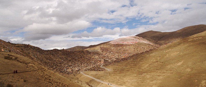
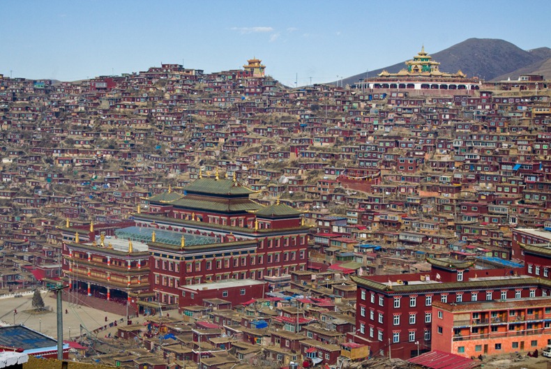
Larung Gar Buddhist Academy, also known as Serthar Buddhist Institute, sits in the Larung Valley at an elevation of 4,000 meters, about 15 km from the town Sêrtar, in Sertar County, Garze Prefecture in the traditional Tibetan region of Kham. The academy was founded in 1980 in an entirely uninhabited valley by Jigme Phuntsok, an influential lama of the Nyingma tradition. Despite its remote location, Larung Gar grew from a handful of disciples to be one of the largest and most influential centers for the study of Tibetan Buddhism in the world. Today it is home to over 40,000 monks, nuns and lay-students.

The campus of Larung Gar is enormous. Houses for monks and nuns sprawl all over the valley and up the surrounding mountains. A huge wall through the middle of Larung Gar separates the monk side from the nun side. Monks and nuns are not allowed out of their designated areas except in front of the main monastery assembly hall which is common to both nuns and monks. The houses are all built in a wood style that is traditionally found in this region, and built so close together that they appear almost on top of each other.


One of the most surprising elements of Serthar is that more than half of those who come to study are women. Entry into the relatively small number of nunneries that exist in other areas of Tibet is limited, but Serthar was open to virtually anyone who genuinely sought to become a student of Khenpo Jigme Phuntsok’s ecumenical vision. Another surprise at Serthar is that it attracts ethnic Chinese students as well as students from Taiwan, Hong Kong, Singapore, and Malaysia, who attend separate classes taught in Mandarin, while larger classes are taught in Tibetan.

Reaching Larung Gar is not an easy task. It is quite remote and the nearest large city is Chengdu, which is 650 kilometers away and takes 13 to 15 hours to reach by vehicle. Sertar is also a sensitive area that is often closed to foreign travelers.


Nuns wash clothes at the Serthar Wuming Buddhist Study Institute on November 4, 2006 in Serthar County of Garze Tibetan Autonomous Prefecture, Sichuan Province, China.


A nun holds sutras and a portable stereo as she prepares to listen to the lecture of a master at the Serthar Wuming Buddhist Study Institute on November 4, 2006 in Serthar County of Garze Tibetan Autonomous Prefecture, Sichuan Province, China. 


Lamas listen to a master as they study sutra at the Serthar Wuming Buddhist Study Institute on November 11, 2007 in the Tibetan autonomous region of China.


A nun puts her shoes on a shelf before she enters a Buddhist hall at the Serthar Wuming Buddhist Study Institute on November 11, 2007 in the Tibetan autonomous region of China.


Nuns buy goods outside a store at the Serthar Wuming Buddhist Study Institute on November 11, 2007 in Serthar County of Garze Tibetan Autonomous Prefecture, Sichuan Province, China.


Sources
READ MORE»