The Valley of 10.000 Smokes

On June 6, 1912, after five days of violent earthquakes on the Alaska Peninsula, one of the most gigantic eruptions of the 20th century occurred from a previously unknown geological formation called Novarupta, Latin for “new eruption”. For 60 hours the eruption sent ash and pumice into the sky as high as 30 km and darkened the sky over most of the Northern Hemisphere. As the ejected materials rained down back into the valley it smothered a 100-square km area with ash and pyroclastic flows up to 200 meters deep. Ash fell two feet deep in the neighbouring Kodiak Island 185 km away, and fumes produced acid rains 600 km away, tarnishing brass as far away as California and Colorado. The high-altitude haze robbed the northern temperate zone of an estimated 10 percent of the Sun’s heat during the summer of 1912.

Four years later when National Geographic Society sent Robert F. Griggs for a cover story, he found the valley engulfed in superheated steam escaping from thousands of fissures and cracks. The incredible sight prompted him to name the once vibrant valley “the Valley of Ten Thousand Smokes.”


Now a hundred years later, most of the fumaroles are extinct and the valley is no longer filled with smoke, but signs of volcanic activity are still visible on nearby hills. The region has been so scarred that in the 1960s it was used in training U.S. astronauts for moon landings. Novarupta itself is a mere bump on the Valley’s floor and rises only 65 meters above its surface. When explorers first entered the Valley, this was one of the hottest areas and the dome still wafts warm steam.

During the eruption a large amount of magma was drained from magma chambers below resulting in the collapse of the summit of another volcano - Mount Katmai, about 10 km away from Novarupta. The collapse produced a crater about two miles in diameter and over 800 feet deep. Early investigators assumed that Katmai was responsible for the eruption. It was not until the 1950s that true source of the eruption was discovered.

Today you can take the trip from Brooks Camp out to the Valley of Ten Thousand Smokes, where the turbulent Ukak River and its tributaries have cut deep gorges in the accumulated ash. The region is still recovering and plants have began to grow on the valley floor. The valley is not yet able to unable to sustain animal life, but moose and bear may cross it from time to time.


Griggs fry bacon over a hot opening of the Valley of Ten Thousand Smokes, 1916


The lava dome of Novarupta today.


Katmai National Park and Preserve, Alaska. Cross section of the June 1912 ash flow exposed by the River Lethe in the Valley of Ten Thousand Smokes.


 Source
READ MORE»

Kiribati - The Land of The Rising Sun

When the sun sets on the evening of December 31 this year, and the world awaits the arrival of the new year, a tiny island country on the extreme east will already have begun celebrations. Located just to the west of the International Date Line, the Republic of Kiribati is one of the first places on earth to see the first rays of the rising sun. Their time zone is 14 hours ahead of UTC - the farthest forward time zone in the world.

The Republic of Kiribati consist of 33 atolls and low coral islands in the central Pacific Ocean dispersed over 3.5 million square kilometres of water. The nation comprises of three island groups - Gilbert Islands, Phoenix Islands, and Line Islands, the last of which are located as far as 30° east of the 180° longitude line. Geographically, Line Islands lie directly to the south of the U.S. islands of Hawaii, and should logically be in the same time zone. But this is not the case, because the International Date Line is not a straight line but zigzags around quite a bit and over the years has been shoved and shifted for various political and economic reasons.


The Island of Kirimati, part of the Republic of Kiribati, is one of the few inhabited islands to experience the arrival of the new year before anybody else.

Take Kiribati itself, for example. Prior to 1995, Kiribati straddled the International Date Line with the eastern and western islands groups having a time difference of 24 hours. This was viewed as an annoying economic nuisance, as there were only four days in each week when both sides experienced weekdays simultaneously, and these were the only days when government offices on opposite sides of the line could conduct business. To put an end to this situation, the president of Kiribati at that time announced that on 1 January 1995 the International Date Line would henceforth move eastwards to go around this country. In doing so, Kiribati became the first nation to greet the rays of the rising sun at the begin of the third millennium. To celebrate the occasion, they even renamed Caroline Island to Millennium Island in the year 2000.

The bending of the International Date Line also created a new time zone UTC+14 that didn’t exist until then. The new development meant that some places were pushed as far as 26 hours behind, or more than a day.


The crooked International Date Line. See how it goes out of the way to wrap around Line Islands.

Taking a cue from Kiribati, another island territory – Tonga, advanced their standard times to UTC+14 and therefore celebrates new year at the same time as the Line Islands in Kiribati. Changes to the date line occurred as recently as 29 December 2011 when yet another island – Samoa moved the international date line to the other side of the country and advanced the country from UTC−11 to UTC+13. Following Samoa’s decision, Tokelau also advanced its standard time from UTC−11 to UTC+13.

Although a nation is authorized to modify their respective time zones, many countries and organizations do not recognize the change. The International Date Line is established by international agreement and there are no treaties or formal agreements associated with the line. Countries are free to choose whatever time zone they wish to observe. This has caused many date line disputes among a handful of island nations each claiming to be the first to celebrate a new year. Then there is the question of whether uninhabited islands count, or whether or not locations within the same time zone but slightly more eastern than the others actually can claim to celebrate the holiday first.

According to the current accepted time zones, the first place to welcome the new year is Kiribati, followed by Tonga. Western Samoa, and Tokelau, follows an hour late. The New Zealand territory of Chatham Islands and the Republic of Fiji follow close behind. The first major city is Auckland, New Zealand, and the last place to celebrate the arrival of the new year is the uninhabited Baker Island and Howland Island, both belonging to the United States.

Correction: Fiji and New Zealand, including the Chatham Islands, has Daylight Saving Time during the Southern Hemisphere Summer, which is around New Year. During this time their time zone advances to UTC+13, except for the Chatham Islands which goes even further to UTC+13.75. This makes New Zealand among the first places in the world to celebrate the New Year - just behind Kiribati's Line Islands. (Thanks Ross).


Satellite photo of Caroline Island, whose name was changed to Millennium Island in 2000 to celebrate the new millennium.


Satellite picture of Atafu Atoll, an inhabited island belonging to Tokelau, that lies in the time zone UTC+13.


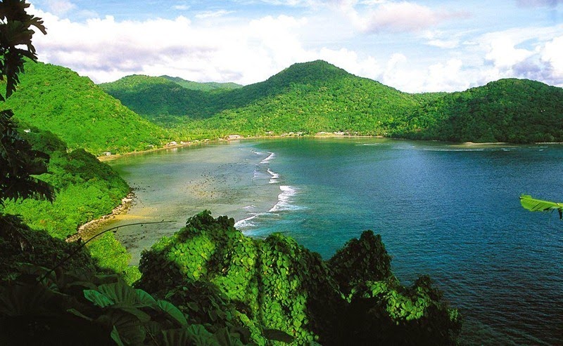
American Samoa, the last place on earth to see the new year.


Source
READ MORE»

Ice Volcanoes in Great Lakes

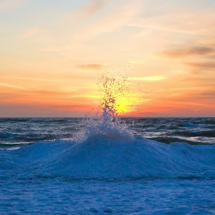
During the winter months, when the Great Lakes in North America freezes over, a unique feature called “ice volcanoes” start forming along the edge of the frozen lakes. As winter ice begins to build along the shores of large lakes, strong winds blowing onshore and wave motion on the waters break up the ice, and they start piling on top of each and building what is known as an ice shelf. Amongst the numerous ice blocks comprising a shelf, many develops cracks.

Waves coming into shore from deeper water strike the edge of the ice shelf, causing them to go under the ice and as the water depth becomes shallow, the energy in the wave causes it to rise up, just like a tsunami. When the energetic wave finds a crack on the ice sheet, it causes the water to sprout creating an ice volcano. If the hole is covered with snow, the eruption may spray snow outward like a volcanic gas cloud.


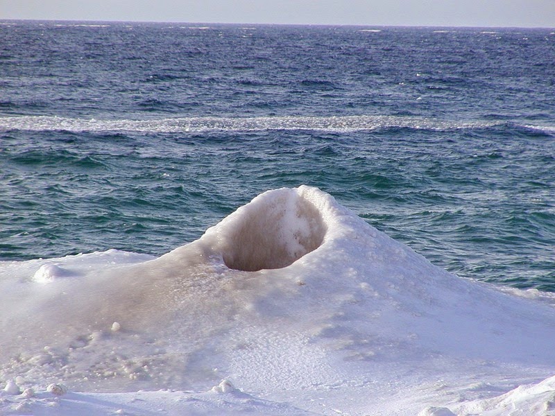
A more appropriate name for these sprouting water holes would have been “blowholes”, but ice volcanoes actually grow just like their geological cousins. As the ejected water falls back onto the ice, it quickly freezes and begins to form an ice cone, a process very similar to the building of a lava cone surrounding a geologic volcanic vent. The ice cones range in size from 3 feet to more than 30 feet high, and spew a mixture of icy cold water and chunks of ice itself.

Not all ice sheets develop ice volcanoes. To build a good ice volcano cone, a unique set of conditions are required - the surface air temperature must be several degrees below freezing and lake waves several feet high and breaking onshore, which is probably why they are seen at very few places such as on the shores of Lake Michigan, Lake Erie and Lake Superior.


Source:
READ MORE»

Grand Canal of China

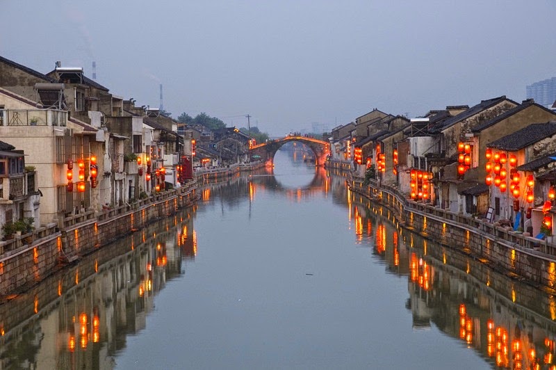
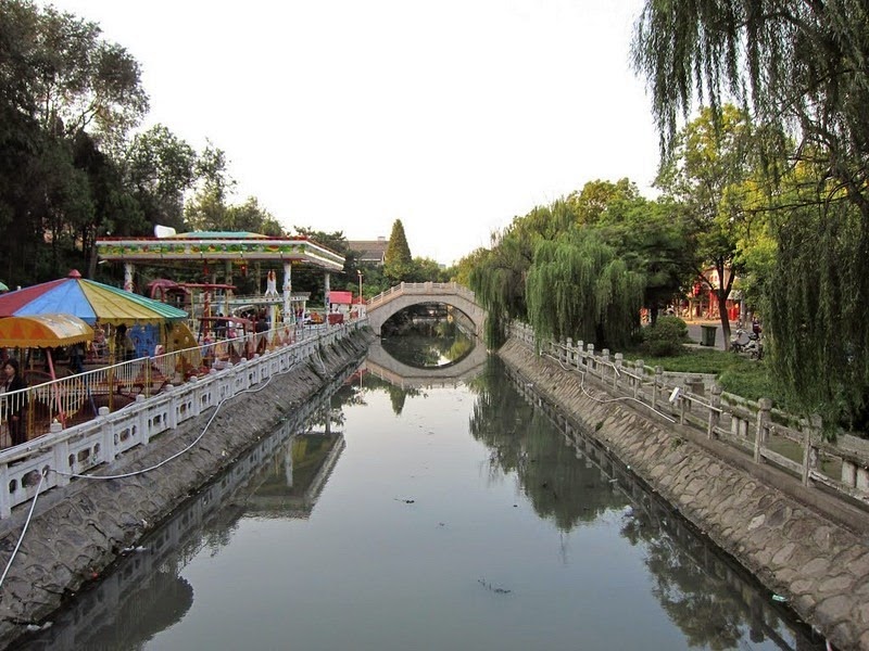
The Grand Canal is a series of waterways in eastern and northern China starting at Beijing and ending at the city of Hangzhou in Zhejiang province, linking the Yellow River with the Yangtze River. Stretching some 1,800 km, it is the world’s longest man-made waterway, and constitutes one of the world’s largest and most extensive civil engineering project prior to the Industrial Revolution. At its peak, it consisted of more than 2,000 km of artificial waterways, linking five of China’s main river basins. The canal was built to enable the transport of surplus grain from the agriculturally rich Yangtze and Huai river valleys to feed the capital cities and large standing armies in northern China. Since then, it has played an important role in ensuring commerce and cultural exchange between the northern and southern regions of eastern China and is still in use today as a major means of communication.


The canal was built in sections in different areas in different periods, starting from 5th century BC, but it wasn’t until the 7th-century when a major expansion was carried out, under the direction of Emperor Yang of the Sui dynasty, bringing the canal to the magnitude it’s known for today. Emperor Yang needed a way to move rice from the fertile region around the Yangtze northwest to feed his capital and his armies which were constantly battling nomadic tribes. More than 3 million peasants were pressed into service, supervised by thousands of soldiers. The project took six years to complete, but by that time, approximately half of the peasant workers were dead of hard labour and hunger. But for all the sufferings, the canal proved indispensable for the movement of food supplies. By the year 735, nearly 150 million kilograms of grain were shipped annually along the canal. Other goods, from cotton to porcelain, were also traded, helping China’s economy bloom.

When the Mongol Yuan dynasty (1271–1368) moved the capital of China to Beijing, it eliminated the need for the canal arm to reach west to Kaifeng or Luoyang. A shortcut was made over Shandong province which shortened the length of the Grand Canal by as much as 700 km, and set the present route of the Canal.


In the middle of the Ming dynasty (1368-1644) the canal was overhauled, and a series of fifteen locks was engineered in western Shandong. By this time the imperial transport army had grown to 15,000 boats and employed 160,000 soldiers who supplied the manpower to pull loaded barges when necessary. The successive improvements to the canal allowed the rulers to more easily conduct tours of inspection of their holdings to the south, enabling a greater control of their realm.

Construction of the canal led to many extraordinary engineering innovations. In 587, the world’s first lock gates were invented by the Sui Dynasty engineer Liang Rui for one of the canal’s original sections along the Yellow River; in 984, a transport commissioner named Qiao Weiyo invented the Grand Canal’s first pound lock – the lock that we see in modern canals even today.

When railway became available, the canal gradually fell into disuse and disrepair. Today, only the section from Hangzhou to Jining is navigable. The central and southern sections are maintained and used mainly to transport coal from the mines in the Shandong and Jiangsu provinces. Other sections of the Grand Canal have suffered from a build-up of mud and the northernmost section has all but dried up.


Source
READ MORE»

The Palace and Tomb of King Herod

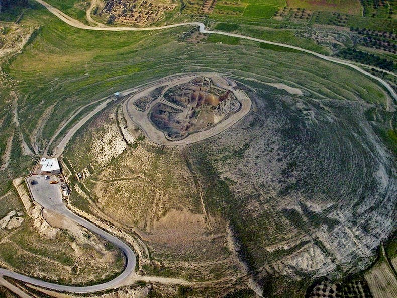
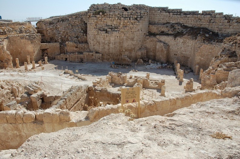
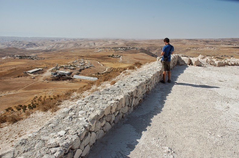
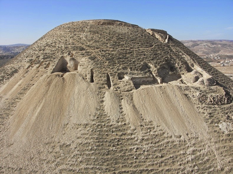
Located 12 km south of Jerusalem, in the Judean desert, Herodium looks like an extinct volcano, but it really is a fort built by King Herod the Great between 23 and 15 BC. King Herod’s palace and fortress was built atop a natural hill, raised to a greater height by heaping earth around the walls, creating a cone-shaped mountain. The complex was surrounded by double walls seven stories high, within which Herod built a palace that included halls, courtyards and opulent bathhouses. At the base of the fortress was an impressive royal compound with magnificent gardens. A special aqueduct brought water to the desert from the area of Solomon’s Pools near Bethlehem. Being the highest peak in the Judean desert, Herodium commanded a breath taking view, overlooking the desert with the mountains of Moab to the east, and the Judean Hills to the west.


According to the Roman Jewish historian Josephus, Herodium was built on the spot where Herod won a victory over his Hasmonean and Parthian enemies in 40 BC. To commemorate the event, the king built a fortress and a palace there, which he named after himself. He also built, in the plain below the hill, an administrative center for the region. The importance of Herodium to the king is clear from the fact that it is the only monument he constructed to which he gave his name. Since the site had little strategic value to warrant the construction of a fort, it’s believed that Herodium’s sole purpose was to provide a place for the king to live out his last years.

After Herod’s death in 4 BC, Herodium became part of the kingdom of his son Archelaus, who ruled for about 10 years. The Roman procurators then held the place until the outbreak of the Great Revolt in 66 AD. During this revolt, rebels entrenched themselves at Herodium until the Romans defeated them in 71 AD. The fortified mountain palace served as an important center for the rebels during the Bar Kokhba Revolt in the 2nd century. As part of their defense measures, the rebels dug secret tunnels around the cisterns, and hid there. These tunnels can still be explored today.

The site remained deserted until the 5th, when a large community of monks took residence in the area and constructed four churches at the base of the hill. The settlement at Lower Herodium continued to exist until the 8th century, after which Herodium lay abandoned. It was only in the 1970s, that archaeologists began exploring the site. As the excavation progressed, extensive restoration was carried out on the structures of Herodium. Today it is possible to walk on a comfortable path to the top of the fortress, to climb its walls and to enjoy, as in the past, the view of the surrounding region.


Source
READ MORE»