Great Wall of Gorgan

The Great Wall of Gorgan is a series of ancient defensive fortifications located near Gorgan in the Golestān Province of northeastern Iran, at the southeastern corner of the Caspian Sea. At 195 km long, the wall is second only to the Great Wall of China as the longest defensive wall in existence, but until recently, nobody knew who had built it. Theories ranged from Alexander the Great, in the 4th century BC, to the Persian king Khusrau I in the 6th century AD. Archeological evidence and scientific dating now suggest that the wall was built in the 5th or 6th century AD, by the Sassanian Empire. This makes the wall over a thousand years older than the Great Wall of China, and even more impressive is the fact that it’s more solidly built than the early forms of the Great Wall.


The wall is made from tens of millions of standardized red bricks made from the local loess soil and fired in kilns, as opposed to a mixture of earth, brick, wood and stone. These red bricks have given the wall the nickname “Red Snake”.

The length of the wall is not exactly known for its western terminal was flooded by the rising waters of the Caspian Sea, while to the east it runs into the unexplored mountainous landscape of the Elburz Mountains. But the wall was at least 195 kilometers long and 6–10 meters wide. A canal, 5 meters deep, with a continuous gradient ran alongside most of the Wall, conducting water from a reservoir constructed in the highlands down into the Caspian basin. Aside from functioning as a water supply, the canal served as a defensive moat. Along the length of the wall there were built as many as 30 fortresses spaced at intervals of between 10 and 50 km. Researchers estimate that some 30,000 soldiers could have been stationed along its length.

Today, much of the ancient wall lies in ruins, having been eroded over time leaving little more than a scar across the landscape.
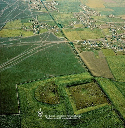


A section of the wall.


Source
READ MORE»

he Mysterious Lakes of Badain Jaran Desert

The Badain Jaran Desert occupies parts of China and Inner Mongolia covering an area of 49,000 sq. kilometers making it the third largest desert in China. Although not a lot of people are familiar with this desert, outside China, it is known for having the tallest stationary dunes on earth. Some of these dunes have been measured to reach heights of more than 500 meters. Badain Jaran has an extremely arid climate with an annual precipitation between 50-60mm. Nearly 40-80 times of the precipitation gets evaporated away before it falls as rainfall.

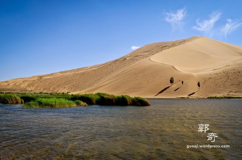
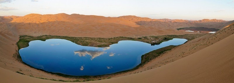
Despite these dry conditions, one of the most remarkable feature of Badain Jaran is the existence of nearly 140 permanent lakes that lie between the dunes. It’s these lakes that give the desert its name which in Mongolian means "mysterious lakes".


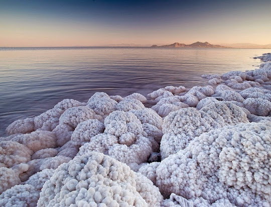
These mysterious lakes are believed to be fed by underground water springs that flow under the gravel deposits and appear between the dunes where the deposits become fine-grained and the water flow is blocked. The source of this water is precipitation and snowmelt in the mountains surrounding the desert hundreds of kilometers away. Runoff from these mountains flows through the fractured rocks and through gravel deposits beneath the desert, and emerge at scattered places giving rise to numerous lakes. Although the springs carry fresh water, most of the lakes are saline, which can be explained by their high rate of evaporation. Some of the lakes change color due to the presence of a large populations of algae, brine shrimp and minerals. Evaporation have also led some hypersaline lakes to form salt crust around the rim of the lakes.

The fresh water lakes provide the life sustenance in the desert supporting camels, goats and horses which are herded by nomads that travel through the desert. Most lakes also support a green ring of vegetation that populate the close vicinity around the lakes.

In recent decades, some of these lakes have shrunk or even disappeared, as a result of reduction in groundwater brought about by urbanization, irrigation, water diversion, and an increase in population.


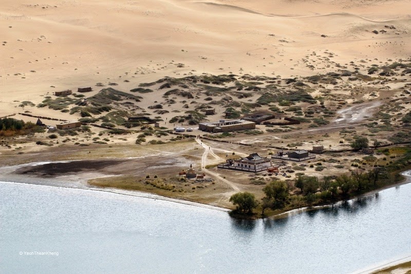
A satellite photo shows a section of the Badain Jaran desert littered with dozens of lakes.


Source
READ MORE»

The Disappearing Lake Urmia of Iran

Lake Urmia, in north-western Iran, was once one of the largest permanent saline lake in the world and the second largest in the Middle East, after the Dead Sea. At its full size, it extended as much as 140 km from north to south and 85 km from east to west, covering an area larger than 5,200 square km. Historically, the lake attracted many species of migratory birds including flamingos, pelicans, ducks and egrets. The lake itself is home to a unique brine shrimp species, Artemia urmiana, and along with the surrounding wetlands and upland habitat, it supports many species of reptiles, amphibians and mammals. The watershed of the lake is an important agricultural region with 6.4 million people depending on it.

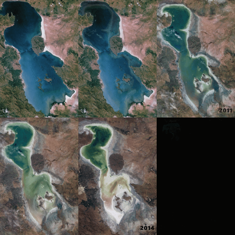
But for the last two decades, the lake has been shrinking drastically. It’s southern end has almost dried up reducing the surface area to 2,000 square km and its water volume has shrunk nearly 95 per cent. Diversion of water for irrigation process and prolonged drought are said to be the causes.


Satellite picture of Lake Urmia, taken on June 23, 2014

Lake Urmia is an endorheic or terminal lake meaning that the lake has no outflow, and the only way water leaves the lake is by evaporation. As many as thirteen rivers dump their waters into the lake, with the largest being Zarrineh Rood River which accounts for the majority of the Lake’s water budget. Additional input comes from rainfall directly over the lake, floodwater and a very small fraction from groundwater flow.

The most significant cause of Lake Urmia's decline is the diversion of water from its rivers. Other contributing causes being reduced rainfall, warmer temperatures and groundwater abstraction. The number of wells pumping groundwater increased from a few thousand in 1973 to over 70,000 in 2005.


Satellite imagery from 1984 to 2014 revealing Lake Urmia's diminishing surface area.

The drying up of Lake Urmia has significantly affected the lake’s shrimp population. Because the lake has no outlet, Lake Urmia is very saline and the loss of water has increased the lake’s salinity to the point that it’s now threatening the survival of the shrimps. The lake's brine shrimp are responsible for the production of the lake's algae and the diverse migratory bird population which feeds on these shrimp. The loss of the brine shrimp would translate into the loss of many of Lake Urmia's migratory bird populations and affect the entire ecosystem's sustainability.

One can draw a parallel between the fate of Lake Urmia and the tragic demise Aral Sea in western Uzbekistan. Once one of the world’s largest lakes, the Aral Sea faded away due to diversion of water for agriculture from the two rivers that fed the lake. Over the course of five decades its surface area dropped to less than 10% of its original extent in the 1960s.

The drying up of Lake Urmia, however, underlies a broader water problem. In recent years, several large Iranian rivers have dried up, and so has Iran's third-largest lake, Hamoun, in the southeast.

New Scientist reported last year that the Iranian government had earmarked half a billion dollars in a bid to restore the once-enormous lake by proper water management, reducing farmers' water use, and restoring the local environment.


Source
READ MORE»

Chan Chan - World’s Largest Adobe City

Located near the Pacific coast in the Peruvian region of La Libertad, 5 km west of Trujillo, Chan Chan was the largest Pre-Columbian city in South America and the largest earthen architecture city in the world. It was the capital of the Chimú civilization, that stretched along the northern coast for a thousand kilometers from just south of Ecuador down to central Peru. The city itself was built around 850 CE and lasted until its conquest by the Inca Empire in 1470.

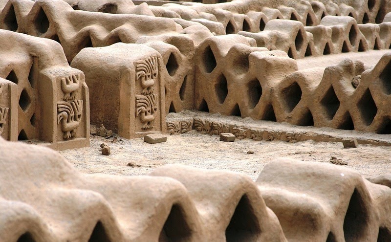
At the height of the Chimú empire, Chan Chan spread over 20 square km with a monumental zone of around 6 square km in the center, and housed an estimated 60,000 inhabitants. The city had nine large rectangular citadels surrounded by thick earthen walls 30 to 60 feet high. Within these units, were thousands of buildings including temples, residences, storehouses are arranged around open spaces, together with reservoirs, and funeral platforms. The walls of the buildings were often decorated with raised carvings representing abstract motifs and animals.


Outside these nine rectangular units were four industrial sectors dedicated to woodwork, weaving, and the work of gold and silver. The city was deprived of these precious metals by Spanish treasure hunters who plundered the city during the 16th century. An area further to the south was used for farming; the land watered by an intricate system of irrigation.

Chan Chan was established in one of the world's bleakest coastal deserts, where the average annual rainfall was less than a tenth of an inch. It was this dry desert air that allowed the city’s earthen structure to remains to this day. Ironically, due to the changes in weather pattern, today Chan Chan is threatened by too much water, as torrential rains gradually wash away this ancient city.


Source
READ MORE»

Stingray City in Grand Cayman

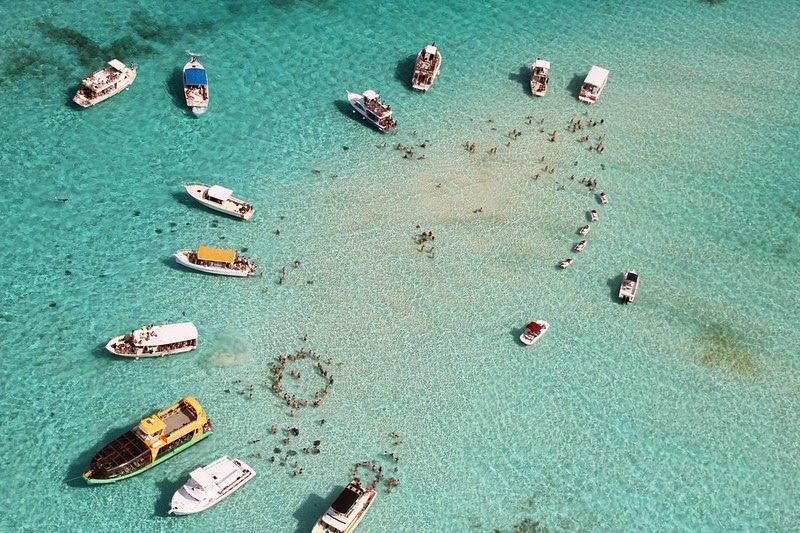
Stingray City is an area of shallow sandbars in the North Sound of Grand Cayman, in Cayman Islands, in western Caribbean Sea. It’s Cayman Islands’ most popular tourist attraction where southern stingrays are found in abundance and visitors can pet and interact with the animals.

The stingrays began gathering in the area during the 1980s when fisherman, returning from an excursion, stopped in the area to clean their fish in the calm water of the shallows and sandbar. The fish guts and squid that were thrown overboard attracted the stingrays who normally feed on mollusks and crustaceans, and on the occasional small fish. Soon the stingrays began to associate the sound of a boat motor with food. Years went by, and eventually some local divers realized that the stingrays could be fed by hand.


Today, an estimated 30 to 40 Southern Stingrays have made Stingray City their home, surviving on squid and food offered by snorkelers and divers. Many tour and excursion boats, along with private watercraft, gather at Stingray City in large numbers. The water is three to five feet in depth – perfect for swimming and snorkeling.


Source
READ MORE»