Kelley Island's Glacial Grooves

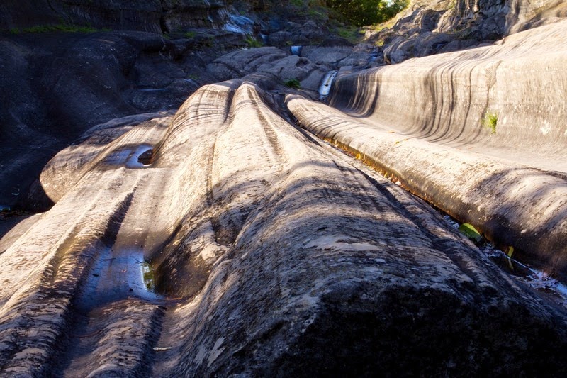
Many of the geological features on the surface of this planet has been shaped by ancient glaciers. These gigantic sheets of ice of immense weight moving across the earth have carved gorges, grinded rocks into fine gravel, raised sea level and left boulders at unexpected places when they melted away. But it’s another thing to hear a geologist say “the sand in this desert was created by glaciers” or “this gorge was carved by glaciers” and quite another to actually see scratches and grooves on the bedrock left behind by glaciers as it dragged over the surface. These abrasions are called Glacial Grooves and the most outstanding example of this feature can be found at Kelleys Island, in Ohio, in the United States.

Glacial grooves, also called glacial striations, were first recognized as the result of a moving glacier in the late 1700s by Swiss alpinists. They were also one of the first to realise that if they were visible today, then the glaciers must also be receding.


Ice, however, is not hard enough to cut through a rock. It’s the rock fragments and sand grains embedded underneath the glacier that provide the abrasive power to cut trough-like glacial grooves. The finer sediments in the base of the moving glacier further scour and polish the bedrock surface, forming a glacial pavement.

The glacial grooves on the north side of Kelley’s Island are the largest easily accessible such grooves in the world. They were scoured into solid limestone bedrock about 18,000 years ago by the great ice sheet which covered part of North America. This impressive groove is 400-feet long, 35-feet wide, and up to 10-feet deep. The ice which created these grooves were probably hundreds of feet thick and flowed from the north in what is now the Lake Erie basin. The grooves were under several feet of soil before they were dug out in the 1970s.

At one time Kelley's Island had a much larger glacial groove area with grooves over 2,000 feet in length. It was called the “Great Grooves”. Unfortunately, active quarrying in the area destroyed most of the grooves. The remaining grooves are now protected and fenced in, although open for public. The old rock quarry is still visible behind the Glacial Grooves State Memorial.




Source
READ MORE»

Monemvasia

Monemvasia is a Gibraltar-like rocky island off the east coast of the Peloponnese, in Greece, and linked to the mainland by a short causeway. The island is about 300 meters wide and a kilometer long, and rises in a plateau, a hundred metres above sea level. On the slope of this plateau, on the seaward side and hidden from the mainland, lies a small town. This remarkably romantic walled town, nestled under the shadow of the towering rock is a living museum of Byzantine, Ottoman, and Venetian history dating back to the 13th century.

Monemvasia was settled in the 6th century by the inhabitants of ancient Laconia seeking refuge from the Slavic invaders who dominated much of Greece between 500 to 700 AD. The rocky island had been separated from the mainland by an earthquake in 375 AD. Over the next several centuries, Monemvasia changed hands again and again, back and forth, between the Venetians and the Turks, until it was liberated during the Greek War of Independence in the early 19th century.


The name Monemvasia is derived from two Greek words, mone and emvasia, meaning "single entrance" and refers to the narrow causeway which is the only way to enter the town.

The island was initially settled on the top of the plateau, which is now referred to as the “Upper Town”. Gradually the settlement spread down the hill, and thanks to its uniquely well-defended position, developed into a powerful town. In the declining days of the Byzantium Empire, Monemvasia became its main city and one of the great commercial centers of the Byzantium world and a major trading port, with a population of 40,000. By the 18th century, Monemvasia went into decline until it was re-discovered by tourists in the 1970’s.

Slowly, the town is resurging in importance – this time as tourist destination with an increasing numbers of tourists visiting the region during the summer. The medieval buildings have been restored, and many of them converted to hotels, and there are plenty of places to eat.


The church of Agia Sofia.


Source
READ MORE»

Floating Tree Trunks on Spirit Lake

The May 18, 1980 eruption of Mount St. Helens, a volcano located in state of Washington, was one of the most destructive events in the history of the United States. In just a matter of hours, the north face of the volcano collapsed creating a huge landslide - the largest debris avalanche in recorded history – that moved swiftly towards the surrounding lakes and the North Fork Toutle River valley leaving a trail of destruction 27 km long. Located only about 5 miles north-northeast of the volcanic crater, Spirit Lake received the full impact of the lateral blast.

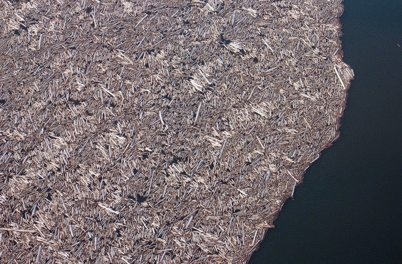
An estimated 1 million trees were blown away from the surrounding hillside by a super-heated wall of volcanic gas and searing ash and rock, and these along with other rubble were deposited on Spirit Lake. The debris avalanche temporarily displaced much of the lake from its bed sending 600-foot-high waves crashing into a ridge north of the lake. As the water moved back into its basin, it pulled with it thousands of more trees into the lake. About 350,000 acre-feet of pyrolized trees were deposited into Spirit Lake and these shattered trees formed a floating log raft on the lake surface that is present to this day, more than three decades after the event.


A portion of the thousands of trees that remain floating in a giant raft on the surface of the lake. Photo taken on March 29, 2007. 

Prior to the eruption, Spirit Lake was a popular and picturesque body of water and was well known to many people as a vacation spot. There were six camps on the shore and a number of lodges catering to visitors.

Today, Sprit Lake is a wasteland choked with thousands of logs and volcanic debris. Huge quantities of debris decreased the lake volume by approximately 46,000 acre-feet, and its depth by 80 feet. Lahar and pyroclastic flow deposits from the eruption blocked its natural pre-eruption outlet to the North Fork Toutle River valley at its outlet, raising the surface elevation of the lake by 200 feet.

When scientists saw the mass destruction, they realised that Sprit Lake provided them with a rare opportunity to study microbial and chemical transformations and the biological restoration of a lake severely impacted by a major volcanic disturbance. To ensure protection of Spirit Lake and other recovering ecosystems inside the volcano's 220-square-mile blast area, the Mount St. Helens National Volcanic Monument was created in 1982. Fishing and other recreational activities potentially disruptive to Spirit Lake's recovery are prohibited. This is one of the primary reasons why no attempts were made to recover the logs and other forest debris floating in the lake.


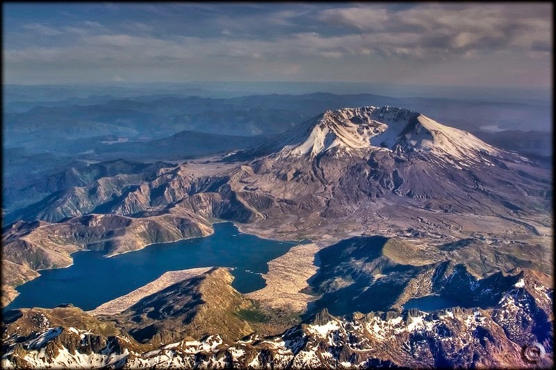
The collapsed crater of Mount St. Helen with Spirit Lake in the foreground.


Blowdown of trees from the May 18, 1980 eruption of Mount St. Helens. Elk Rock is the peak with a singed area on the left.


Thousands of trees in the North Fork Toutle River drainage area are shown blown down by the force of the May 18, 1980, eruption of Mount St. Helens, seen on Aug. 22, 1980.


Massive blowdown of trees in the Green River valley seen on June 2, 1980. The flattening of the forest resulted from the May 18 eruption of Mount St. Helens.


Logs covering Spirit Lake, 2009.


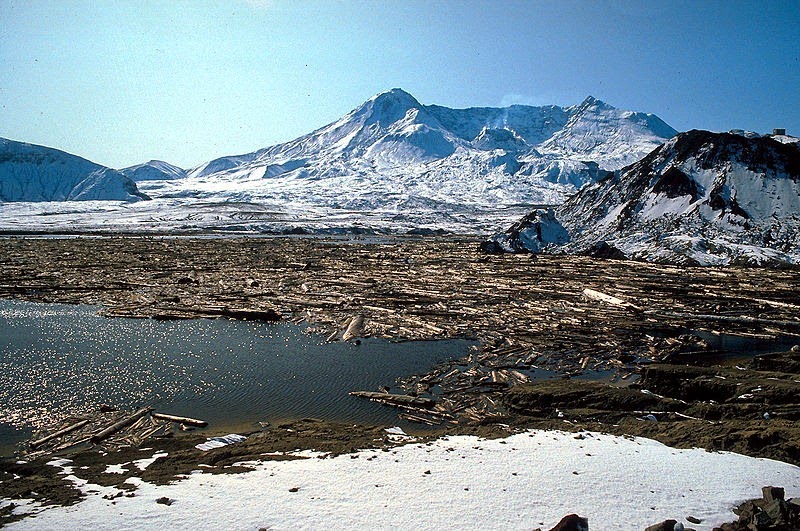
Spirit Lake log mat in 1985.


View of Spirit Lake, southwest looking down to southern end . Blast-fell logs litter the banks or still float after the lake had been drained to maintain a safer water level since avalanche debris and trees had raised the level by several hundred feet.


Spirit Lake on the slopes of Mt. St. Helens in Washington State, USA. This photo was taken two years after the eruption and shows the ruined lake filled with debris from the eruption.


A road through the blast zone. Picture taken in 2009.


Broken stumps of trees litter the regions around Mount St. Helen.


Source
READ MORE»

Ruth Glacier

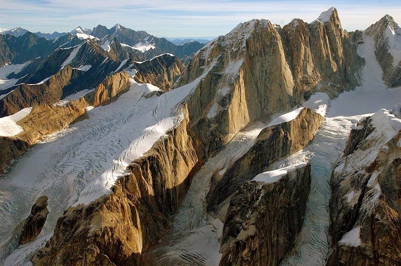
The Ruth Glacier, in Denali National Park and Preserve in the U.S. state of Alaska, covers an enormous area in the heart of the central Alaska Range. Located about 3 miles vertically below the summit of Mt. McKinley, it catches all the snow that falls on the southeast side of the mountain, and as the accumulated snow and ice that makes up the glacier slides down the slope, it get squeezed through a one-mile-wide bottleneck of what is called the Great Gorge.

The Great Gorge is one of the most spectacular gorges on earth. It runs for a length of 16 km and drops almost 2,000 feet over the distance, creating a grade that forces the Ruth Glacier to descend at an impressive pace of a meter a day. On either side of the gorge are solid granite cliffs that tower 5,000 feet above the glacier's surface. The depth of the ice within the gorge is more than 3,800 feet. If the ice were to melt tomorrow, it could create an abyss 2.6 km deep or more than one-half times deeper than the Grand Canyon.


The mountain lining the walls of the Great Gorge rises sporadically into towering spires and has been given names such as Moose's Tooth, Broken Tooth, Bear Tooth and Wisdom Tooth, to name a few, and really look like animals' teeth. So immense are these spires that what appear to be tiny flakes on these walls are actually ledges wide enough to park a tractor trailer.

As the Ruth Glacier flows down a steeper gradient, it tears and fractures into a treacherous 10-square mile section known as the Ruth Ice Fall near the bottom of the Great Gorge. During summer after the snowmelt, this section becomes virtually impassable.


Source
READ MORE»

Blythe Intaglios - The Nazca Lines of United States

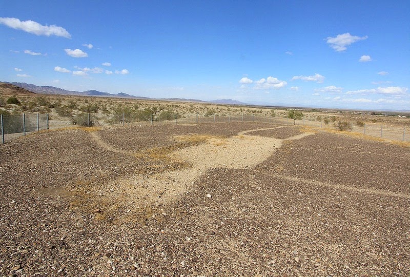
About 15 miles north of Blythe, just west of U.S. Highway 95 near the Colorado River, are a group of gigantic geoglyphs. There are a total of six distinct figures in three locations, including a human figure at each location and animal figures depicting serpents and quadrupeds at the other two sites. The largest human figure measures 171 feet from head to toe. But from the ground level, the figures are indiscernible, nor they are visible from any nearby hill from any distance or angle. Just like Peru’s famous Nazca Lines, they can only be seen from the air. And that is precisely how Blythe Intaglios were discovered.

Unseen by modern humans until the 20th century, these huge figures hidden on the desert floor were discovered in 1931 by local pilot George Palmer when flying over Blythe. Palmer reported seeing outlines of two human figures, serpents and four-legged animals with long tails. Another giant figure appeared just to have stepped out of a large dance ring.


Palmer’s discovery led to a survey of the area by Arthur Woodward, Curator of History and Anthropology at the Natural History Museum of Los Angeles County, leading to the geoglyphs being classified as a “Historical Landmark”. However, with no resident custodian, the site soon became subject to decay by vandalism. During the World War II, Blythe was even used as a desert training area and tanks and other equipment destroyed some of the intaglios. It wasn’t until 1952 when the National Geographic Society and the Smithsonian Institution sent airborne archaeologists to the site and published an extensive article on the magazine along with aerial photographs, that Blythe Intaglios became known to the outside world. Today, a protective fence around the geoglyphs keep people from walking on top of them.

The figures at Blythe were created by scraping away the dark colored topsoil and rock to expose the light-colored soil underneath, and then piling dark gravel around the figures to outline them. The fine particles have been washed and blown away over the centuries, leaving larger stones or pebbles on the surface.

It is difficult to say how old the Intaglios are, since dating techniques have not been developed to date these types of features. Their age could be anywhere between 450 years to 2,000 years old. It's believed intaglios were made by ancestors of today's Native Americans living along the Colorado River. According to Native American oral histories, the human figure may represent the Creator, while the animal figures may represent mountain lions who helped in the creation. They are most likely a message to the gods, which a common theme throughout human civilization.


Source
READ MORE»