Kungur Ice Cave, Russia

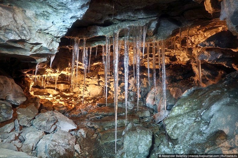
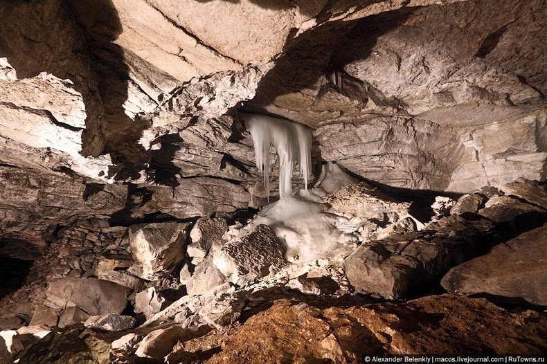
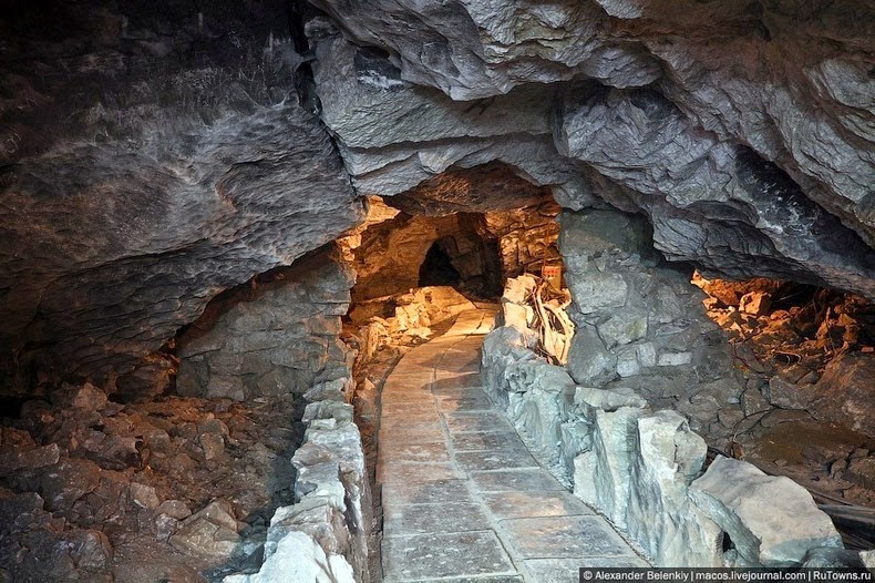
Kungur Ice Cave is a karst cave located in the Urals, near the town Kungur in Perm Krai, Russia, on the banks of the Sylva River. With a length of explored passages over 5 km, it is one of Russia’s biggest karst caves and the only one in the country equipped for visits by tourists. Over thousands of years rainwater dissolved the soft rocks and formed a system of spacious underground halls, filled with rocks of peculiar shapes. Snow-melt dripping through the porous rocks had frozen in the cold interior of the cave to turn into ice stalactites that hang from the ceiling in completely unpredictable forms and remarkable sizes. Some of the hanging icicles have reached the floor and formed spectacular ice columns shaped like giant hourglasses.


One of the most beautiful places in the cave is right near the entrance: the Diamond grotto. Layers of ancient ice in these chambers overflow under spotlights, bringing to mind a frozen waterfall, while vaults cover large crystals. Diamond grotto adjoins Polar grotto where it is possible to observe ice stalactites and stalagmites. In the grotto of Pompeii Ruins visitors can see rocks of strange shapes some of them resembling silhouettes of animal and fantastic characters, thanks to the special system of illumination.

In all, Kungur Cave contains 48 grottoes, each having their own story and unique name. For example, there are the Coral and Sea Bottom chambers, which are ornamented with stone lace that water wore away for 12,000 years. In the Meteorite chamber, a viewer has the illusion that huge celestial bodies are lying under the earth.

The first plan of the ice cave was made in 1703 when Peter the Great issued the decree sending the well-known geographer Simeon Remezov. Using the materials of Remezov drawings, Stralenberge (a member of Messershmidt Siberian expedition) made one of the first schemes of the cave which we can see now.

The first regular excursions of the ice cave was made by Alexey Timofeevich Hlebnikov, the grandnephew of the Russian America researcher K.T.Hlebnikov. In 1914 Hlebnikov, having rented the cave from a local community of peasants, started to arrange paid excursions for inhabitants of Kungur and visitors of the city. Owing to Alexey Hlebnikov's diligence, the news about Kungur’s outstanding ice cave quickly scattered to different corners of the country. Today the cave is visited by hundreds of thousands of visitors each year.





Source
READ MORE»

Laguna Colorada, Bolivia

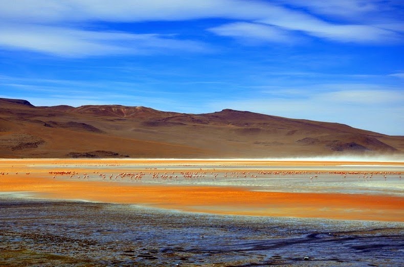
Laguna Colorada, or the Red Lagoon, is a shallow salt lake located at an altitude of 14,000 feet in the southwest of the altiplano of Bolivia, within Eduardo Avaroa Andean Fauna National Reserve and close to the border with Chile. Dotted with white islands of massive borax deposits, the nearly 15,000-acre salt lake is less than three feet deep, and is tinted blood red due to a variety of algae which thrive in the salt water. The plankton rich lake draws a large number of endangered James flamingos, which is another highlight of the lake.

The altiplano has many large lagoons also known for their brilliant colours due to the minerals in their waters, for instance, Laguna Verde is known for its remarkable emerald-green waters. But Laguna Colorada is the only large red lagoon in the Reserve.


The majority of the landscape around Laguna Colorada is desert rocks and salt deposits. The air temperature is often below freezing at dawn but warms decently during the summer months making excursions into the Reserve quite pleasant. Another famous location, the salt flats of Salar De Uyuni, lies not far away.

The Reserve around Laguna Colorada is home to a wide variety of indigenous birds and animals that amazingly thrive in the hostile landscape. Three of the world's six flamingo species - Chilean, Andean and James flamingoes - inhabit the freshwater lakes and saltwater lagoons of the Reserve. The Reserve also provides habitat to mammals include pumas, Andean foxes and cats, domesticated llamas and alpacas, as well as reptiles, amphibians and fish.


Source
READ MORE»

The Volcano with Perfect Cone

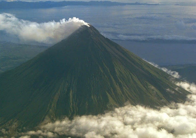
Mount Mayon, also known as the Mayon Volcano, is an active stratovolcano on the island of Luzon in the Philippines, renowned for its almost symmetric conical shape. Mayon is considered to have the world's most perfectly formed cone due to its symmetry, which was formed through layers of pyroclastic and lava flows from past eruptions and erosion.

The volcano is located on the convergent boundary where the Philippine Sea Plate is driven under the Philippine Mobile Belt. The lighter continental plate floats over top of the oceanic plate, forcing it down into the Earth's mantle, and allowing magma to well up from the Earth’s interior. The magma exits through weaknesses in the continental crust, one of which is Mount Mayon. In fact, Mayon is the most active volcano in the Philippines having erupted over 49 times in the past 400 years. Despite this, the volcano has managed to retain its perfect cone shape without suffering any major slides or collapse.


Mayon volcano is the main landmark of Albay Province rising 2462 meters above the Albay Gulf with very steep upper slopes averaging 35-40 degrees capped by a small summit crater. Because of its symmetric cone, the mountain was declared a national park and a protected landscape on July 20, 1938, the first in the country.

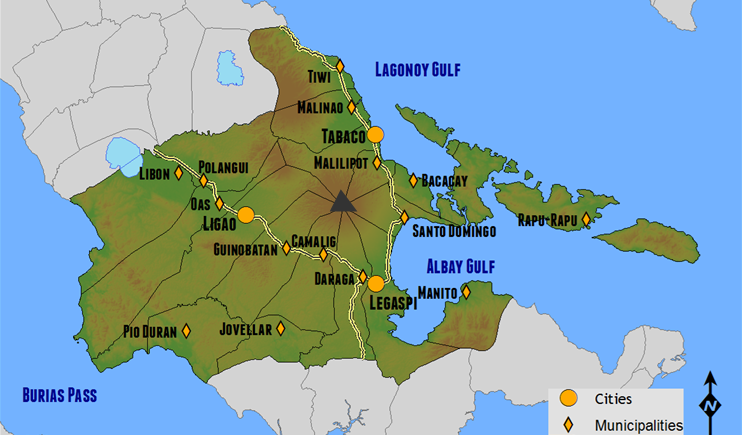
Another peculiarity is that Mayon volcano is geographically shared by the eight cities and municipalities which meet at the cone’s summit, dividing the cone like slices of a pie when viewed from above.


The location of Mayon in Albay province and the eight cities and municipalities that share the volcano


Source
READ MORE»

Mexican Venice

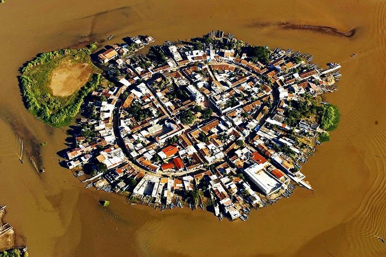
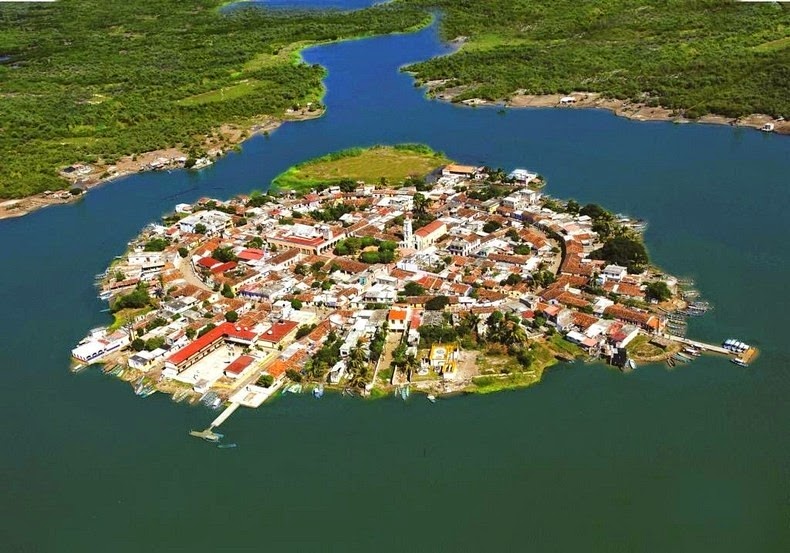
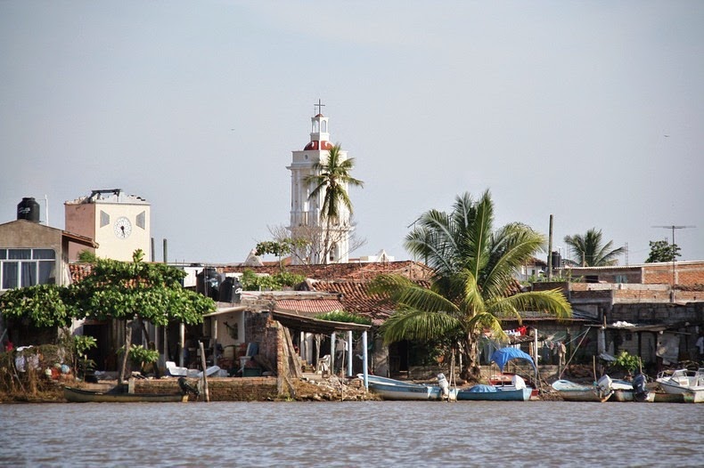
Mexcalitán is a small village on an island located in one of the lakes in the estuaries north of San Blas, in the municipality of Santiago Ixcuintla, in the Mexican state of Nayarit. The island is fascinating to look from the air. Two parallel streets cross the oval-shaped island from north to south, and two others from east to west, where they intersect in the middle to form a modern plaza. The only other street runs around the island in a circle, parallel to and not far from the water’s edge. There is church, a few shops, a billiards hall, a museum, and an administrative office at the central area of the village, while low houses, of adobe, brick and cement, line the dirt streets and extend right down to the water’s edge. For several months during the rainy season, the rising waters flood the streets making travel by boat the only option. For this reason, the island has earned the name “The Mexican Venice.”


This ancient island village is believed to be the ancestral homeland of the Aztecs before they set out on their pilgrimage in 1091 to found Tenochtitlan (modern Mexico City). These days Mexcaltitán is mostly a tourist town with shrimp fishing the main economic vocation of the island’s inhabitants. Men head out into the surrounding wetlands in the early evening in small boats, to return just before dawn with their catch. All day long, shrimps are spread out to dry on raised sidewalks. Aside from providing space for sun-drying of shrimps, these high curbs protect houses from flooding when water levels rise too high.


Source
READ MORE»

Manjanggul Lava Tube in Jeju Island

The volcanic island of Jeju, located 130 kilometers from the southern coast of the Korean Peninsula, has an extensive system of lava tubes. These natural conduits through which magma once flowed are now empty caves that are some of the largest in the world. These caves, apart from providing opportunities for scientific research, are popular tourist destinations.

The most impressive is the Geomunoreum Lava Tube System formed by the flow of basaltic lava when the Geomunoreum volcano erupted some 300 - 200 thousand years ago. The volcano has an elevation of 456 meters and lava flowed down to the coastline 13 km away, and while doing so, created numerous lava tubes. The Manjanggul Lava Tube represents the largest cave in this system. It stretches for 8,928 meters and its passages are up to 30 meters high and 23 meters wide.


The insides of the tube is adorned with multi-coloured carbonate decorations and innumerable cave formations commonly found in lava tubes. They include lava stalactites and lava stalagmites, lava columns, lava flowstone, lava helictites and lava blister, cave corals, benches, lava raft, lava bridges, lava shelves and striations. At the end of the one of the passageways open for tourists, is a massive lava column formed when a large amount of lava spilled from the upper level down to the lower level. This intimidating column stands 7.6 meters high and is the largest known in the world.

Some 30,000 common bent-wing bats (Miniopterus schreibersii) have taken permanent residence inside the tube, forming the largest colony of bats so far known to be living in Korea. About 38 types of cave creatures have been identified inside the Geomunoreum Lava Tube System, the most common of which is the Jeju cave spider (Nesticella quelpartensis).


Entrance to the cave.


The world's largest lava column in Manjanggul cave.


Source
READ MORE»