Kinderdijk's Windmills

The village of Kinderdijk is located in the Netherlands, about 15 km east of Rotterdam. Kinderdijk is situated in a region called the Alblasserwaard that lies below sea-level. Called polders, these regions are often land reclaimed from a body of water, such as a lake or marshes. After the water is drained out of the water bodies, the ground level subsides over time and eventually all polders sink below the surrounding water level. Water then enters the low-lying polder through water pressure of ground water, or rainfall, which has to be regularly pumped out or drained by opening sluices at low tide. In Kinderdijk, most of the water originates from the rivers Lek and Noord, at the confluence of which the village is located.

To drain the polder, a system of 19 windmills was built between 1738 and 1740. Their purpose was to pump the excess water into a reservoir until the level of the river had fallen enough to pump the water back into river Lek. This group of mills represents the largest concentration of old windmills in the Netherlands, and is today a popular tourist site. They have been a UNESCO World Heritage Site since 1997.


In Alblasserwaard, problems with water became more and more apparent in the 13th century. Initially, large canals, called "weteringen", were dug to get rid of the excess water in the polders. However, the drained soil started setting, while the level of the river rose due to the river's sand deposits. After a few centuries, an additional way to keep the polders dry was required. It was then the decision to build a series of windmills was taken. At one time there were more than 150 windmills in the Alblasserwaard and Vijfheerenlanden area. This dropped to 78 in the 1870s, but today the total is only 28, of which 19 are in the Kinderdijk area.

Although the windmills have been replaced by more efficient diesel pumps, they are still maintained in operating condition because they function as fall-back mills in case of failure of the modern equipment. The windmills were used for the last time during the second World War, when the mechanical pumps could not be used any more due to fuel shortages.

During the summer months, the mills are put back in operation again for the sake of the tourists. In one of the windmills a small museum is established with an exhibition about how miller-families lived.


Source
READ MORE»

Tourlitis Lighthouse

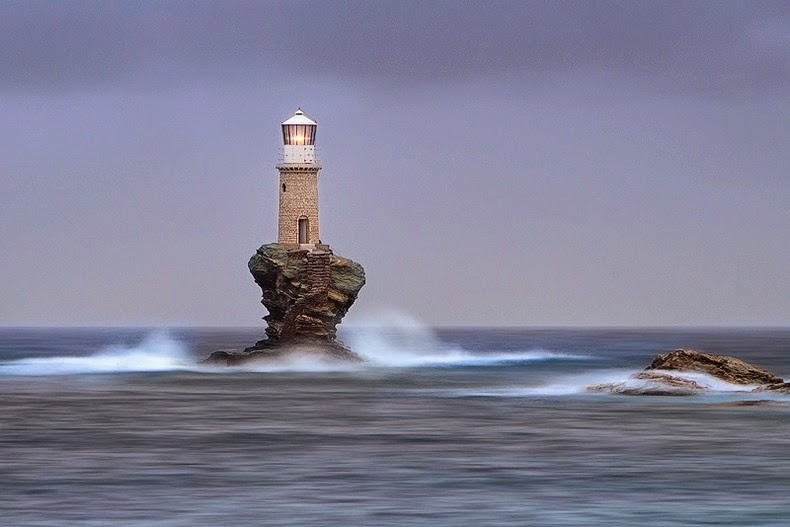
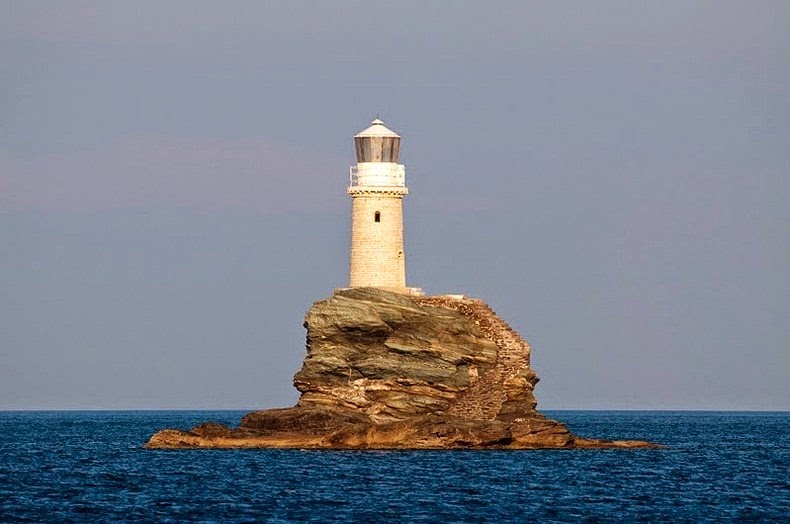
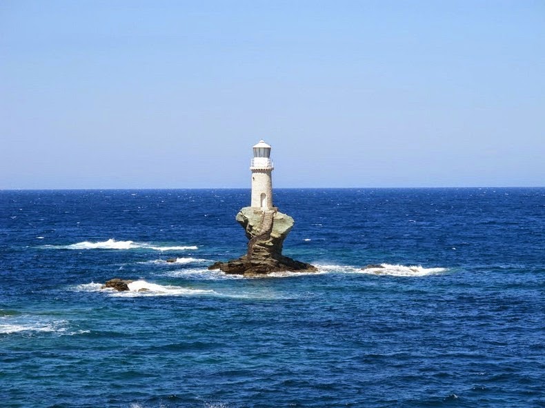
The charming little Tourlitis Lighthouse is perched on the islet of Tourlitis, a chunk of rock opposite the harbor at Chora, on Andros island. It is Greece’s first modern lighthouse and the most picturesque. The lighthouse is located about 200 meters out to the sea. A flight of stairs carved into the rocks lead to the lighthouse.

The Tourlitis Lighthouse is the only Greek lighthouse to be built entirely by Greek hands, and also the nation’s only wave-swept rock sentinel, exposed to the brunt of heavy seas. This is the first automatic lighthouse of the Greek lighthousing system, as the lighthouse keeper doesn't actually reside there.


The first lighthouse here was built in 1897. After that was destroyed in the Second World War, a simple scaffold tower was erected on Tourlitis. The present lighthouse is a replica of the original, and was built in 1990s at the expenses of Alexandros Goulandris, an oil tycoon of Andros island. Goulandris and his wife dedicated the lighthouse in memory of their deceased daughter Violanda.


Source
READ MORE»

Rani Ki Vav Stepwell

Rani Ki Vav is an 11th-century-stepwell situated in the town of Patan in Gujarat, India, on the banks of the Saraswati River. The stepwell is said to have been constructed by Udayamati, the widowed Queen of Bhimdev I (AD 1022 to 1063), around 1050 AD in memory of the king. Bhimdev I was the son of Mularaja, the founder of the Solanki dynasty of Anahilwada Patan. The stepwell was later flooded by the nearby Saraswati river and silted over until the late 1980s, when it was excavated by archeologists. When restored, the stepwell’s magnificent carvings were found in pristine condition.

Stepwells are a distinctive form of subterranean water resource and storage systems on the Indian subcontinent, and have been constructed since the 3rd millennium BC. They evolved over time from what was basically a pit in sandy soil towards elaborate multi-storey works of art and architecture. Rani-ki-Vav was built at a period when craftsmen were at the height of their stepwell construction ability. The Maru-Gurjara architectural style reflect mastery of this complex technique and great beauty of detail and proportions. Befitting its name, the Rani-Ki-Vav is now considered to be the queen among step wells of India. Chand Baori, in Rajasthan, is another exceptional example of this technology.


Designed as an inverted temple highlighting the sanctity of water, it is divided into seven levels of stairs with sculptural panels of high artistic quality. There are more than 500 principle sculptures and over a thousand minor ones that combine religious, mythological and secular imagery, often referencing literary works. The fourth level is the deepest and leads into a rectangular tank 9.5 m by 9.4 m, at a depth of 23 m. The well is located at the westernmost end of the property and consists of a shaft 10 m in diameter and 30 m deep. The building itself measures 64 meters by 20 meters.

Below the last step of the step well, there is a gate that leads to a tunnel 30 kilometer long that opens at the town of Sidhpur near Patan. It was built as an escape gateway which could be used by the king in the event of defeat during a war. The tunnel is now blocked by stones and mud.

In the 13th century, geotectonic changes lead to massive flood and disappearance of the Saraswati river, following which the stepwell ceased to function as a water well. Above all, it buried the property under several layers of slit for almost seven centuries. It was the silt carried by the flood caused during this historic event, which allowed for the exceptional preservation of Rani-ki-Vav, until it was discovered less than 30 years ago.

Rani ki vav was included in the list of UNESCO's World Heritage Site on 22 June 2014.


Source
READ MORE»

The Land of Fire - Azerbaijan

Azerbaijan, located within the South Caspian Sea basin, is among the world's oldest oil producers. The petroleum industry in Azerbaijan produces about 800,000 barrels of oil per day and 1 billion cubic meters of gas per year. There is so much oil and natural gas reserve under the Absheron Peninsula that the ground practically leaks all over.

Throughout Azerbaijan, numerous fires have been burning since antiquity and these were reported on by historical writers such as Marco Polo in the 13th century, and later by the famed writer Alexandre Dumas, who described a Zoroastrian fire temples built around a natural fire. This phenomenon of spontaneous fire caused by gas seepage have given Azerbaijan the moniker "Land of Fire." It also created a cult of fire worshippers – the Zoroastrians, which first appeared in this region over 2,000 years ago before the Islamic rule came into effect. Numerous references to fire can also be found in Azerbaijan’s folklore and culture.

There are at least three places where one can observe Azerbaijan’s famous fires.


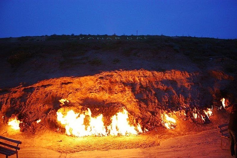
Yanar Dag, the burning mountain, in Azerbaijan.


Yanar Dag 
Yanar Dag, which literally translates to "burning mountain", is a natural gas fire which blazes continuously on a hillside near Baku, the capital of Azerbaijan. Flames jet out into the air 3 meters from a thin, porous sandstone layer. Around this open fireplace the atmosphere is filled with the smell of gas. The naturally occurring fire burns in colorful flames most impressively at dusk, when both tourists and locals can view it from nearby teashops.


Ateshgah of Baku
The Ateshgah of Baku near Baku, off the Greater Caucasus, is another famous site of Azerbaijan’s eternal fires. Ateshgah means “temple of fire”. This pentagonal complex, which has a courtyard surrounded by cells for monks and a tetrapillar-altar in the middle, was built during the 17th and 18th centuries. The fire was once fed by a vent from a subterranean natural gas field located directly beneath the complex, but heavy exploitation of the natural gas reserves in the area during Soviet rule ended the flow of natural gas to the temple and extinguished the holy fire in 1969.

The temple was converted into a museum soon after the fire went out. Today, the fire that can seen here is fed by mains gas piped from Baku city.


Yanar Bulag
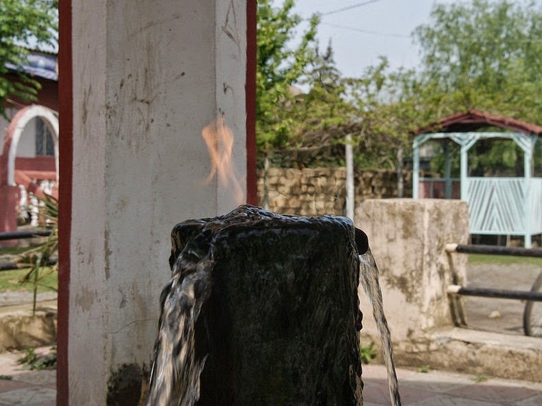
Yanar Bulag or the "burning spring" is located to the city of Astara in southern Azerbaijan. It consist of a metal stand pipe inside a small pavilion through which water comes gurgling out. It looks nothing unusual, but when you light a match and touch the water, the water itself is set ablaze. This occurs due to the water’s high methane content.

The locals believe the water from the spring has remedial properties, and would often take a drink while the flame is alit. There are always people at the spring who stop by to fill their bottles and carry on their journeys.


Source
READ MORE»

Karajia Purunmachos

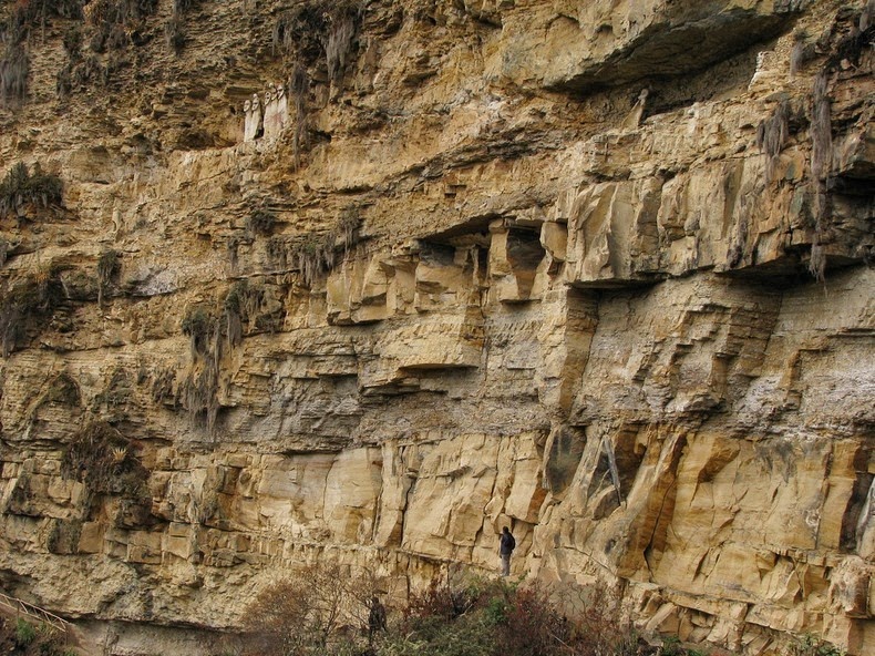
About 60 km northeast of the city of Chachapoyas, in Luya Province, in Peru, lies the archaeological site of Karajia, where the funeral tombs of the “ancient wise men” are located. Perched high on a ledge by the side of a limestone cliff, the six sarcophagi (coffins carved in stone and displayed above ground) resembling six limbless torsos with large heads and enormous jaw lines, stand proud with their chin up and facing the abyss. Some of the headpieces are embellished with horns, imitating deer antlers, while others have encrusted human skulls, which are presumed to be trophy heads. Each sarcophagus is 2.5 meters tall.

The sarcophagi were built by the Chachapoya people to house the remains of important individuals in their culture, about 600 years ago. Originally, there were eight sarcophagi but two were destroyed by earthquakes and other natural elements. Their inaccessible location high above a river gorge has thankfully preserved them from destruction by looters.


The sarcophagi are shaped like large capsules built of a mixture of clay, straw and gravel spread on a wooden structure, and each has room to house one mummy. The deceased were placed in the fetal position, wrapped in a cocoon of wild cane stalks tied up with twine. This structure was then covered up with a thick layer of clay and straw as a binding material. Afterwards, the head was sculpted and placed on top. The sarcophagus body was painted white, while the head and headpiece were decorated with delicately brushed ocher strokes. Feathered tunics, also painted with ochre, adorned the body of the sarcophagus. The gender of the deceased was also displayed on the cone-shaped body of each sarcophagus.

The Sarcophagi of Karajia are not the only ones in the Chachapoyas area, but they are the most important ones. On the western bank of the Utcubamba River north of Kuelap many other sarcophagi of varying sizes have been recorded. The sarcophagi are so inaccessible that only a few archaeologists and TV crews have managed to get close to them.

The "Purunmachos" as the local people call them were exposed to the world in 1984 after their discovery by the archaeologist Federico Kauffmann.


Source
READ MORE»