27 Reasons Why You Should Ask for the Window Seat

There are plenty of reasons to ask for a window seat. For starters you can lean on the window if you want to sleep, and you never have to get up for someone else! But it’s what’s outside of that window that is most compelling. The world is a wonderful place, one that looks entirely different from above. From sunrises and sunsets to landscapes, cityscapes and all kinds of cloud formations in between; there’s beauty out there as far as the eye can see.

Here are 27 reasons you should always ask for a window seat.


1. You might see Chicago’s skyline reflected in Lake Michigan


2. You could see a rainstorm like this off in the distance


3. Because a solar eclipse at 44,000 ft is pretty cool


4. And seeing the highest point in Africa will take your breath away


5. For the sunrises


6. And the sunsets


7. And the waterfalls you’ll never see from the aisle

Kaieteur Falls, Guyana


8. You could witness a forest fire


9. And finally understand why everyone thinks Norway is so beautiful


10. You could ride an endless sea of clouds


11. Come up with creative ways to frame a shot


12. And appreciate the expanse of a mountain range

The Pyrenees


13. Maybe you’ll see your first frozen lake


14. Or a city enveloped in fog

Warsaw, Poland


15. Cities at night can be mesmerizing too

Los Angeles, USA


16. And you can see history in an entirely different light

Prambanan Temple, Indonesia


17. You can laugh at clouds because they look like cotton balls


18. Or perhaps, see your first volcano

Mount Taranaki, NZ


19. You can find a river through a sea of clouds


20. And nothing beats the view of a city from above

New York City, USA


21. The same can be said for mountains like Fuji


22. And Rainier


23. Forget outside! Even the windows themselves can be interesting


24. And there’s always time for another sunset


25. Now that’s amore


26. It gives you a chance to say a final goodbye to the place you just left


27. And last but not least…
Beverage carts and passengers won’t bump into you on their way by!


Source
READ MORE»

Diomede Islands

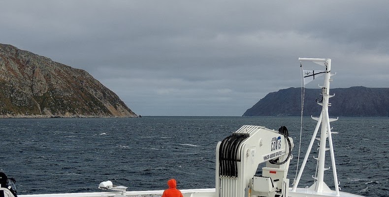
The Diomede Islands are a pair of rocky islands located in the middle of the Bering Strait between mainland Alaska and Siberia. Though the two islands are only 3.8 km apart and clearly in a single group, they are separated by the International Date line which also marks the international border between Russia and the United States. Big Diomede is owned by Russia and Little Diomede is owned by the USA. Additionally, Big Diomede is 23 hours ahead of Little Diomede owing to the International Date Line that passes between them, because of this they are sometimes called Tomorrow Island and Yesterday Isle, respectively.


Both islands are flat-topped, steep-sided and very isolated by its location, by rough seas, and by the persistent fog that shrouds the islands during the warmer months. During the freezing winter, sometimes moving chunks of ice clog in the open waters forming an ice bridge connecting the two islands. At such times one can practically walk between the United States and Russia. Of course, this is only in theory. Crossing the Bering Strait is not legally permitted.

The islands were originally inhabited by Yupik Eskimos as long as 3,000 years ago. The first European to reach the islands was the Russian explorer Semyon Dezhnyov in 1648. Eighty years later, it was re-discovered by the Danish navigator Vitus Bering on August 16, 1728, the day on which the Russian Orthodox Church celebrates the memory of the martyr St. Diomede.

When the United States purchased Alaska from Russia in 1867, it included the Little Diomede. The new boundary was drawn between the two Diomede Islands and the Big Diomede was left to Russia.

While Little Diomede developed into a small community of about 75 individuals, with a church and school, Big Diomede became a Russian military base. After World War II the native population was driven off the island to avoid contacts across the border, and any Little Diomede inhabitants who strayed across the waters too close to Big Diomede where taken captive by the Russians. Today it has no permanent population but it is the site of a Russian weather station and a base of Russian Border guard troops

Little Diomede Eskimos live a subsistence lifestyle, harvesting fish and crab, hunting beluga whales, walrus, seals and polar bears. Most supplies come from an annual barge delivery from the mainland from stores like Wal-Mart. A few residents work for the local government or school. There has been some commercial fishing and mining on the island, but both industries are in decline.


Big Diomede island on the left. Little Diomede island on the right.


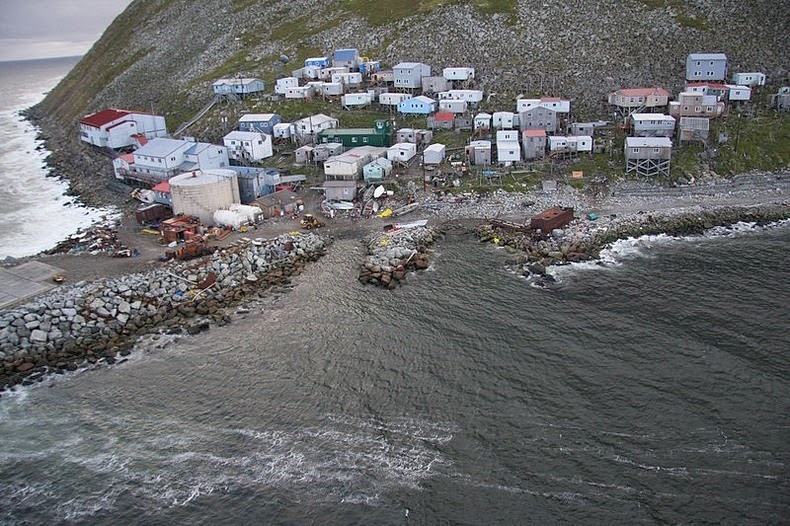
Diomede (Inalik) village on the west coast of Little Diomede Island, Alaska.


The native village of Little Diomede island.


Source
READ MORE»

Batroun's Ancient Sea Wall

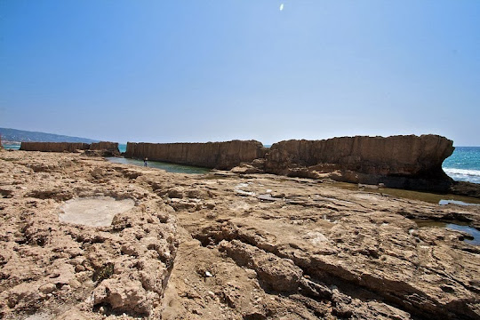
Batroun is a coastal city in northern Lebanon lying 50 km north of Beirut and 30 km south of Tripoli. It is one of the oldest cities in the world with a history of human occupation going back to at least 5,000 years.

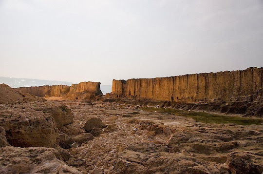
Batroun was once one of the most important Phoenician cities in the region. The name Batroun derives from the Greek, Botrys (also spelled Bothrys), which was later Latinized to Botrus. Historians believe that the Greek name of the town originates from the Phoenician word bater, which means “to cut” and it refers to the maritime wall that the Phoenicians built in the sea to protect them from tidal waves, that still stand today. Other historians believe that the name of the town is derivative of the Phoenician words beit truna, which translates to “house of the chief”.


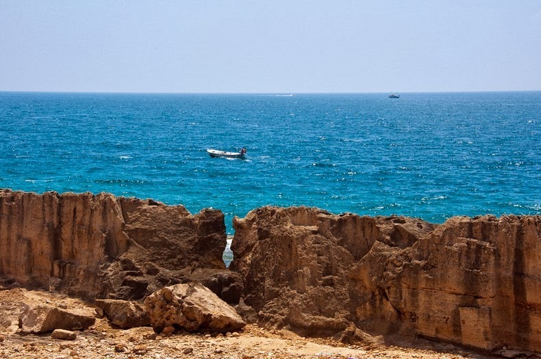
The sea wall was originally a natural structure composed of petrified sand dunes. This was reinforced by the Phoenicians with rocks and the process went on until it took its present shape in the first century B.C. The wall is 225 meters long and 1 to 1.5 meters thick. Parts of it has crumbled but the remaining still stand strong and proud in Batroun’s bay, and is a must see for an authentic piece of Lebanon’s ancient history.


Source
READ MORE»

Old Man of Storr, Scotland

The Old Man of Storr is a large pinnacle of rock located on the north of the Isle of Skye, in Scotland, in an area known as ‘Trotternish’. The 50m-high rocky outcrop of crumbling basalt is prominent above the road 6 miles north of Portree and can be seen for miles around. It is also the highest point of the Trotternish Ridge. The entire Trotternish ridge area was formed by a massive ancient landside, and the Storr, which is composed mainly of ancient lava flows, is the most easily recognizable landmark on the island and one of the most photographed. Indeed, the opening scenes in the Ridley Scott's 2012 movie Prometheus were shot at the Old Man of Storr.

Legend has it that the Old Man of Storr gets its name because the rock outline and the protruding pinnacle resemble that of the face of an old man. “Storr” itself is Norse in origin and is thought to mean “Great Man”. This seemingly unclimbable pinnacle was first scaled in 1955 by English mountaineer Don Whillans, a feat that has been repeated only a handful of times since.


Source
READ MORE»

The Whispering Wall

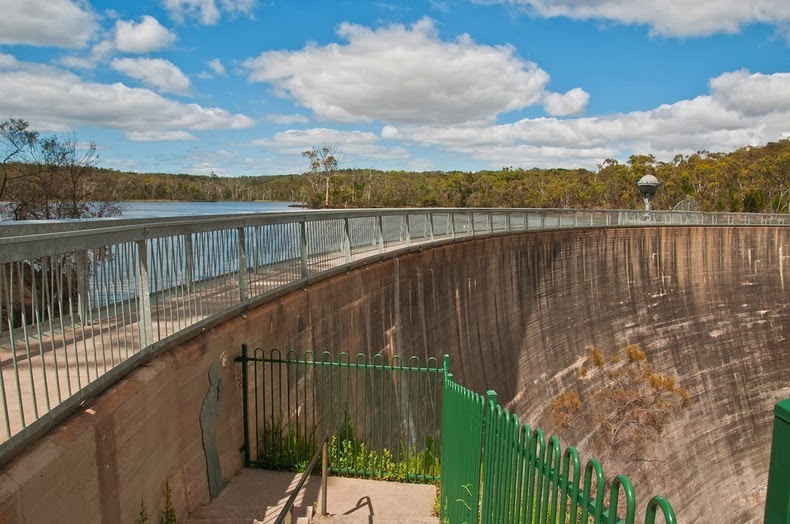
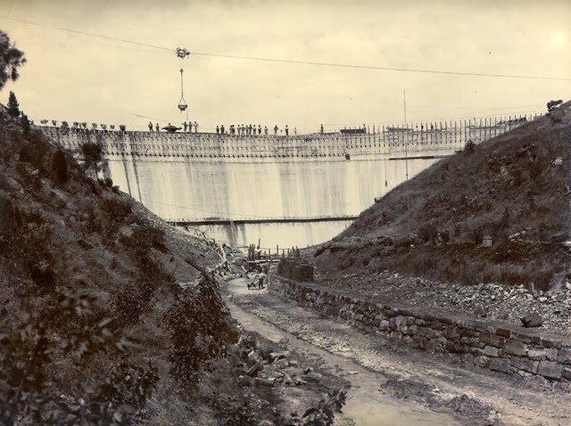
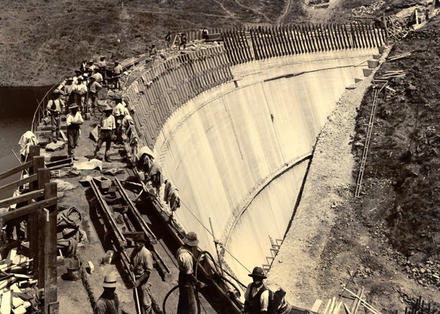
The Barossa Reservoir was built between 1899 and 1902 to supply water to town of Gawler and other northern country areas in South Australia. At the time of its completion, the reservoir was hailed as an engineering marvel. The thin arch of the dam’s retaining wall, curved against the pressure of the water, was an innovation considered radical, and attracted attention from all over the world, even making its way into the pages of the journal Scientific American. At a height of 36 meters, it was also the highest dam in Australia.

But what draws visitors to Barossa Reservoir is the unique acoustic effect of its curved wall. Due it’s parabolic shape, words whispered at one side can be clearly heard at the other, more than 140 meters away, earning the dam the title "Whispering Wall".


The story goes that this feature was first discovered during the construction when a group of workers were overheard complaining about their boss who was on the other side of the dam and it cost them their jobs. This may well be folk lore but it adds some color to the dams history.

The Barossa Reservoir was formed by damming the Yettie Creek gorge in the northern Mount Lofty Ranges, a feat that took over 400 men. Its water comes through a two-kilometer tunnel, carved by horse power, from the South Para River and Reservoir, and is supplemented by the Warren Reservoir and the River Murray. In addition to Gawler and country, a filtration plant constructed in 1982 allows the Reservoir to supply the Munno Para and Elizabeth areas.

Aside from its acoustic attraction, the Whispering Wall offers great views of both the Barossa Reservoir and the surrounding, well-preserved natural bounty. The area abounds in thick scrub, tall red gums, and pines, and a flourishing bird and animal life. It is a popular destination for picnics and bird-watching.


Barossa Reservoir construction pictures.


Source
READ MORE»