Batroun's Ancient Sea Wall

Batroun is a coastal city in northern Lebanon lying 50 km north of Beirut and 30 km south of Tripoli. It is one of the oldest cities in the world with a history of human occupation going back to at least 5,000 years.

Batroun was once one of the most important Phoenician cities in the region. The name Batroun derives from the Greek, Botrys (also spelled Bothrys), which was later Latinized to Botrus. Historians believe that the Greek name of the town originates from the Phoenician word bater, which means “to cut” and it refers to the maritime wall that the Phoenicians built in the sea to protect them from tidal waves, that still stand today. Other historians believe that the name of the town is derivative of the Phoenician words beit truna, which translates to “house of the chief”.


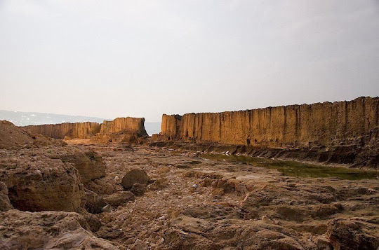
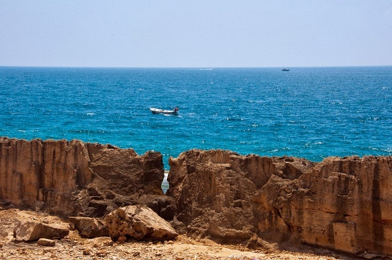
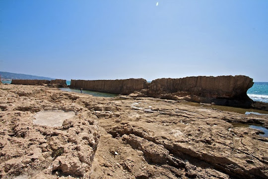
The sea wall was originally a natural structure composed of petrified sand dunes. This was reinforced by the Phoenicians with rocks and the process went on until it took its present shape in the first century B.C. The wall is 225 meters long and 1 to 1.5 meters thick. Parts of it has crumbled but the remaining still stand strong and proud in Batroun’s bay, and is a must see for an authentic piece of Lebanon’s ancient history.


Source
READ MORE»

Old Man of Storr, Scotland

The Old Man of Storr is a large pinnacle of rock located on the north of the Isle of Skye, in Scotland, in an area known as ‘Trotternish’. The 50m-high rocky outcrop of crumbling basalt is prominent above the road 6 miles north of Portree and can be seen for miles around. It is also the highest point of the Trotternish Ridge. The entire Trotternish ridge area was formed by a massive ancient landside, and the Storr, which is composed mainly of ancient lava flows, is the most easily recognizable landmark on the island and one of the most photographed. Indeed, the opening scenes in the Ridley Scott's 2012 movie Prometheus were shot at the Old Man of Storr.

Legend has it that the Old Man of Storr gets its name because the rock outline and the protruding pinnacle resemble that of the face of an old man. “Storr” itself is Norse in origin and is thought to mean “Great Man”. This seemingly unclimbable pinnacle was first scaled in 1955 by English mountaineer Don Whillans, a feat that has been repeated only a handful of times since.


Source
READ MORE»

The Whispering Wall

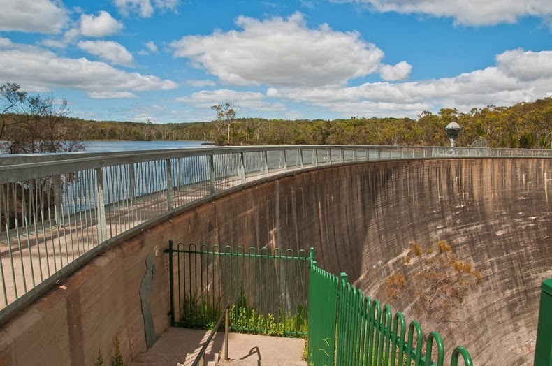
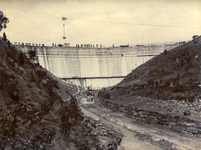
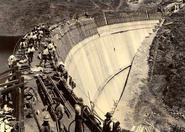
The Barossa Reservoir was built between 1899 and 1902 to supply water to town of Gawler and other northern country areas in South Australia. At the time of its completion, the reservoir was hailed as an engineering marvel. The thin arch of the dam’s retaining wall, curved against the pressure of the water, was an innovation considered radical, and attracted attention from all over the world, even making its way into the pages of the journal Scientific American. At a height of 36 meters, it was also the highest dam in Australia.

But what draws visitors to Barossa Reservoir is the unique acoustic effect of its curved wall. Due it’s parabolic shape, words whispered at one side can be clearly heard at the other, more than 140 meters away, earning the dam the title "Whispering Wall".


The story goes that this feature was first discovered during the construction when a group of workers were overheard complaining about their boss who was on the other side of the dam and it cost them their jobs. This may well be folk lore but it adds some color to the dams history.

The Barossa Reservoir was formed by damming the Yettie Creek gorge in the northern Mount Lofty Ranges, a feat that took over 400 men. Its water comes through a two-kilometer tunnel, carved by horse power, from the South Para River and Reservoir, and is supplemented by the Warren Reservoir and the River Murray. In addition to Gawler and country, a filtration plant constructed in 1982 allows the Reservoir to supply the Munno Para and Elizabeth areas.

Aside from its acoustic attraction, the Whispering Wall offers great views of both the Barossa Reservoir and the surrounding, well-preserved natural bounty. The area abounds in thick scrub, tall red gums, and pines, and a flourishing bird and animal life. It is a popular destination for picnics and bird-watching.


Barossa Reservoir construction pictures.


Source
READ MORE»

Tsavo Man Eaters

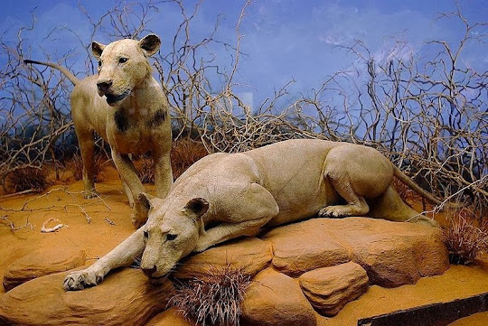
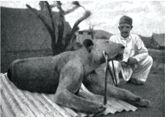
The Tsavo region lies to the south of Kenya close to the borders with Tanzania in the basin of the Tsavo river close to where it meets the Athi River. The Tsavo region had been inhabited for thousands of years by hunter-gatherers, and later by the Kamba people moving through the region herding their livestock or looking for honey. The region achieved notoriety in 1898 during the building of the Mombasa-Nairobi railway, when a pair of lions terrorized the railway workers building a bridge. During a 10-month period the lions killed at least 28 people. The ordeal was put to an end by Lt. Col. John Henry Patterson, who was in charge of the bridge-building, after extensive stalking and baiting. The stuffed body of the two lions can be seen today in the Field Museum of Natural History in Chicago.


In March 1898 the British started building a railway bridge over the Tsavo River led by Lt. Col. John Henry Patterson. Called the Uganda Railroad, it was to stretch from Mombasa on the coast of modern-day Kenya to Lake Victoria, and later into Uganda. During the next nine months of construction, two maneless male Tsavo lions stalked the campsite, dragging Indian workers from their tents at night and devouring them. Crews tried to scare off the lions and built campfires and bomas, or thorn fences, around their camp for protection to keep the man-eaters out, to no avail; the lions leaped over or crawled through the thorn fences. After the new attacks, hundreds of workers fled from Tsavo, halting construction on the bridge. Patterson set traps and tried several times to ambush the lions at night from a tree.

After repeated unsuccessful endeavours, Patterson got his first breakthrough on 9 December 1898 when he managed to put a bullet on the first lion. The shot struck the lion in its back leg, but it escaped. Later, it returned at night and began stalking Patterson as he tried to hunt it. A shot through the heart eventually killed the lion. The second lion was killed twenty days later. Patterson had to fire at least nine times before it was dead. He claimed it died gnawing on a fallen tree branch, still trying to reach him.

The lions were enormous in size. The first one measured nine feet, eight inches from nose to tip of tail and stood three feet nine inches high. It took eight men to carry the carcass back to camp. After 25 years as Patterson's floor rugs, the lions' skins were sold to the Chicago Field Museum in 1924 for a sum of US$5,000. Today, they are on permanent display along with the original skulls.

The exact number of people killed by the lions is unclear. Patterson’s figure of 135 victims is believed to be exaggerated. The actual number is likely around 35, arrived by analyzing samples of hair and bone of the lions.

The man-eaters’ notorious exploits have been immortalized in no less than three Hollywood films, including the 1996 movie The Ghost and the Darkness where Val Kilmer played the daring Patterson.


The first of the two Tsavo man-eating lions shot by Lt. Col. Patterson.


The second man-eater from Tsavo shot by Lieutenant-Colonel Patterson.


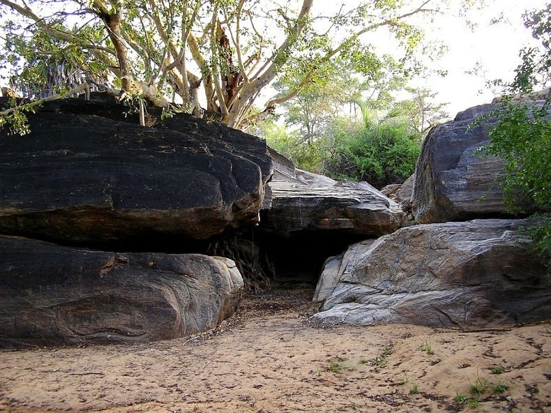
The man-eaters’ den.


Source
READ MORE»

China Grand Canyon

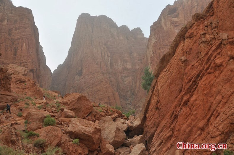
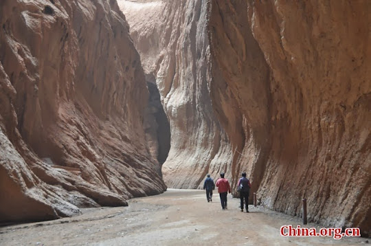
These pictures of great sandstone walls were not taken at the Antelope Canyon in Arizona, but rather in Keziliya Mountain, about 70 km north of Kuqa in Xinjiang Uygur Autonomous Region in China. The Keziliya Grand Canyon, also called the Tianshan Grand Canyon being located at the south foot of the Tianshan Mountain, is about 5.5 km long from east to west and was formed due to erosion by flash flooding over thousands of years, just like its bigger brother in Arizona. The canyon is characterized by oddly-shaped rocks, pinnacles, rugged cliffs and deep ravines. These have been given various names such as “Skyworth Valley”, “Sacred Snake Valley”, “Skyscraper Cave Valley”, “Rock of tenterhook”, “Swan Peak” and “Lover’s Peak”, to name a few.


The width of the canyon varies along the length. While the broadest point is 150 feet (50 meters) wide, the narrowest place is 1.3 feet (0.4 meter), just barely enough for a single person to squeeze through sideways. The deepest cut in the canyon is about a 100 meters deep.

About 1,400 meters into the canyon, and 35 meters high up, is located the cave of “a Thousand Buddha”. The cave was built during the Tang Dynasty (618-907) and the murals here are very precious in the study of the art history.


Source
READ MORE»