Huacachina - Magnificent Oasis in Peru

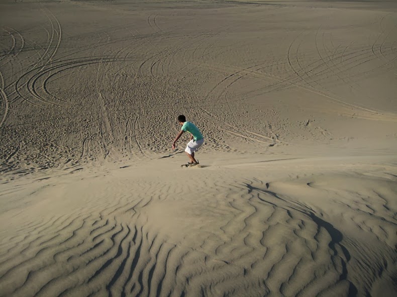
Just 8 km away from the city of Ica, in southern Peru, lies the picturesque desert oasis of Huacachina. Built around a small natural lake and surrounded by enormous sand dunes that stretch several hundred feet high, Huacachina has the looks and feel of a remote Saharan outpost, but in reality is only an hour’s drive away from the Pacific coast. Huacachina has long been a tourist destination for wealthy local families from the nearby city of Ica, and lately a major destination for sandborders who travel from all around the world to ride the peaks.

The oasis is basically a collection of resorts and restaurants around a blue-green lagoon surrounded by huge sand dunes, with a permanent population of around 100, who depend entirely on tourism.


The oasis flourished in the 1940s and 1950s as a getaway for the Peruvian elite and regained a certain prominence through tourism promotion campaigns in the 1990s. Today it is a backpacker’s paradise and a top destination for sandboarding and dunebuggy rides. But tourism is taking its toll on the lagoon.

Groundwater consumption has caused the water level of Huacachina’s lagoon to sink sharply. For the past several years, the lagoon is fed by water from other sources to prevent it from drying up.

Called the "Oasis of America," Huacachina is one of the few remaining natural oases in North and South America.




Source
READ MORE»

Longyou Caves - a 2000 Year Old Secret

When you hear the word cave do you think of a smooth, curved surface with delicate architecture? If you don’t, this has to change today, after one of the most weirdest discoveries made by speleologists in China. Whenever I hear the word ” cave ” immediately I think of words like “rough”, “stony”, “scary”. But that changed completely after finding out about the Longyou Grotto caves… Who do you think carved these caves; Some miners Someone Exquisite architect who wanted to build a house so deep underground that no one does not ever know ? If you think any of the above, you are sadly mistaken…


This complex of caves was carved more than 2,000 years ago and it remains unknown by whom and why. It seems made ​​by people who had access to tools similar to today’s modern tools and machinery ! Without exaggeration! The caves have ceilings up to 30 meters height, a whole area of ​​about 1200 square meters expanding a total volume of 900,000 cubic meters produced by more than 36,000 cubic meters of rubble , 4 columns (pillars) distributed symmetrically inside one of the caves, and more incredible elements that make you wonder “How did they do that ? ” . Not to mention the enigmatic marks on the walls of tools that give the impression of heavy excavators being used during the building of the caves.


In June 1992 a villager named Wu Anai, decided to take water from a local cave , revealing the first of a series of artificial caves in the area. After 17 days of pumping enough water had been removed in order to reveal the cave and enough evidence to show that it was formed not naturally but artificially.


The carving on the walls and ceilings were forms a complicated and not easy to see pattern that many people believe contains symbolism. It’s like some ceramics, located in a nearby museum with chronologies between 500 and 800 BC.

One of the caves which is open to tourists, includes patterns of carving with symbols referring to horses, fish and birds ( Earth, Water, Air ) . The head of the bird has similar look with a statuette which was revealed in the archaeological site of Hemudu.


This discovery has won the interest of many experts from China, Japan, Poland, Singapore and the USA. One of the most difficult questions is how and why they remained hidden and unknown for more than 2,000 years…


Source
READ MORE»

Most Poisonous Tree in the World

The Manchineel tree, native to the western hemisphere, which is known as the most poisonous tree in the world. In places where it grows like Florida, the Caribbean and the Bahamas, the tree is often marked with warning signs, so the people who pass by won’t go near it. The tree is poisonous in so many levels, that if you ever come across one, prefer to stay at least a few meters away from it. The fruit resembles of a small apple, but its consumption will lead you on the way to the nearest hospital. Christopher Columbus and his sailors, referred to it as the manzanita de la muerte which means little apple of death.


Μanchineel


Μanchineel

However the fruit is probably the least dangerous part of the tree. The white milky juice manchineel is extremely caustic and poisonous, and even a drop could cause blistering of the skin, dermatitis, edema or burns. Often victims of the toxicity of this fall are unsuspecting travelers who use the tree as a shelter from the rain. The juice of the tree is so torrid that even the raindrops falling from the branches can cause burns. Finally, the bark is very poisonous and combustion releases smoke which causes temporary and in some cases permanent blindness. According to legend tells of poison tree manchineel killed the Spanish conquistador Juan Ponce de Leon, when fighting with the locals hit by an arrow infused with the juice of the tree, something which led to a slow and painful death.


Μanchineel


Manchineel trees have bright green oval leaves and their height is 15 meters. The dense foliage is tempting for those seeking shade or protection from rain while its fruit is sweet in the beginning but with disastrous consequences for the continuum. Fortunately, injuries have become rare due to warnings about the dangers of the tree.


Source
READ MORE»

Popeye Village

When Walt Disney and Paramount Pictures decided to make a movie based on the popular cartoon strip Popeye, the production team picked the opened faced Anchor Bay in the north-west corner of the Mediterranean island of Malta, two miles from the village of Mellieħa, as location for Popeye’s fictional village of Sweethaven.

Construction of the film set started in June 1979. A construction crew of 165 worked over seven months building the village as described by the comic strip’s creator E.C. Segar. Nineteen authentic wooden buildings were built from hundreds of logs and several thousand wooden planks imported from the Netherlands, while wood shingles used in the construction of the roof tops were imported from Canada. Eight tons of nails and two thousand gallons of paint were consumed in construction. In addition, a 200–250 foot breakwater was built around Anchor Bay's mouth to protect the set from high seas during the shooting.


Filming commenced on January 1980, and the live-action musical comedy featuring Robin Williams playing as Popeye the Sailor was released on December the same year. Although the movie earned three times its budget, it was written off as a flop because it was nowhere near the blockbuster that Paramount and Disney had expected.

Today the movie set is open to the public as an open-air museum and family entertainment complex. Aside from the village itself, there are boat trips around Anchor Bay, audio-visual shows which includes clips from the actual film and the set's construction, water trampolines, mini golf, and other games and fun activities.


Source
READ MORE»

Wineglass Bay, Australia

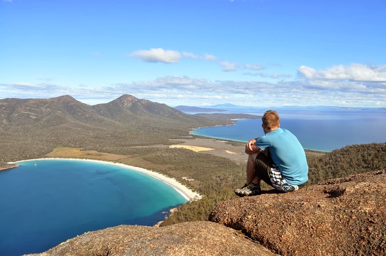
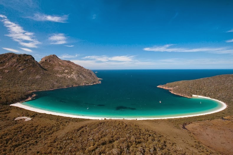
Located on Tasmania’s Freycinet Peninsula, Wineglass Bay is one of the most photogenic beaches in Australia. This crescent-shaped beach of dazzling white sand and sapphire-coloured sea is considered among the top ten beaches in the world.

Wineglass Bay is a good hour’s hike from the Parsons Cove car park, but it’s from the saddle track over the jagged granite peaks called “The Hazards”, that one can have the best view. From this vantage point you can see the beautiful curving, brilliant white sand beach, with a foreground of bright blue water, and background of dense green vegetation.


The beach itself is 1.7 km long and curves round in a northeast-facing arc. Waves are relatively low averaging 50 cm to 1 m in height and decreasing into the southern corner. They surge up a steep, white sand beach face, with no bar and deep water right off the beach. The beach is backed by a low vegetated dune, which forms the eastern side of the 1.5 km wide isthmus bordered in the west by Hazards Beach. Indigo Creek occasionally drains across the more protected southern end of the beach, with boats often moored off the corner.

To the south of Wineglass Bay are 20 km of exposed steep, rugged, pink and grey granite shoreline bordered by 100m high Cape Forestier in the north and 60 m high Cape Degerando to the south.

Winglass Bay is a great location for fishing, sailing, bushwalking, sea kayaking, rock-climbing, or simply soaking up the spectacular coastal scenery. With secluded sandy beaches, luxurious eco-lodges, it has become a favourite honeymoon destination for couples to escape and relax away from the rest of the world.


Source
READ MORE»